 DORIS Geodaten-Katalog
Digitale Orthophotos (DOP)
Digitale Orthophotos in Echtfarbe (RGB), Falschfarbe (CIR-Infrarotnaher Farbbereich), Schwarz-Weiß (SW); Auflösung 0,2m; verzerrungsfreie und maßstabsgetreue Abbildung
Simple
Metadata
- File identifier
- 0206B6C6-4553-4063-B939-B88517978CFC XML
- Metadata language
- de
- Character set
- UTF8
- Metadata standard name
-
OENORM A 2270
- Metadata standard version
-
Ausgabe 2016
- Date stamp
- 2026-04-08T05:29:40.151Z
- Metadata author
-
Organisation name Individual name Electronic mail address Role Amt der Oö. Landesregierung
MSc, MPA, MBA, Christian, Greifeneder
Point of contact
- Hierarchy level
- Dataset
- Dataset URI
-
H:\arcgis\Layerfiles\Gruppenlayer\Orthofotos.lyrx
Identification
- Alternate title
-
H:\d_ortho\orthofotos.gdb
- Date ( Publication)
- 2021-01-01
- Date ( Revision)
- 2026-03-27
- Edition
-
Version 1.0
- Point of contact
-
Organisation name Individual name Electronic mail address Role Amt der Oö. Landesregierung
MSc, Bernhard, Kosar
Processor
Descriptive keywords
- OGD Kategorien ( Theme)
-
-
Geographie und Planung
-
- OGD Keyword
-
-
DOP
-
Orthofotos
-
- Keywords
-
-
DOP
-
Orthofotos
-
Internetfreigabe
-
OGDFreigabe
-
OGDnoExport
-
Legal constraints
- Use limitation
-
no limitations
Legal constraints
- Access constraints
- Other restrictions
- Other constraints
-
Creative Commons Namensnennung 4.0 International (CC BY 4.0) https://creativecommons.org/licenses/by/4.0/deed.de
- Classification
- Unclassified
Technical information
- Spatial representation type
- Grid
- Metadata language
- de
- Character set
- UTF8
- Topic category
-
- Planning cadastre
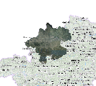
Spatial Information
))
Temporal extent
Temporal extent
Data quality information
- Hierarchy level
- Dataset
- Statement
-
Durchführung von Bildmessflügen
Conformance result
- Date ( Creation)
- 2011-04-11
- Explanation
-
unbekannt
- Pass
- No
Reference System Information
- Projection
- EPSG:31255
Distribution Information
- Distribution format
-
Name Version Specification jp2 1.0
Overviews
Spatial extent
Provided by
