 DORIS Geodaten-Katalog
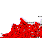
Gemeindehauptorte OÖ
Stark generalisierte punktuelle Darstellung der Hauptorte der Gemeinden auf Basis der ÖK50 (M 1:50.000).
Simple
Metadata
- File identifier
- 03DA87EE-4701-475B-8CFC-E4FCD2E7A0C2 XML
- Metadata language
- de
- Character set
- UTF8
- Metadata standard name
-
OENORM A 2270
- Metadata standard version
-
Ausgabe 2016
- Date stamp
- 2026-04-07T11:01:34.417Z
- Metadata author
-
Organisation name Individual name Electronic mail address Role Amt der Oö. Landesregierung
MSc (GIS), Christoph, Kastl
Point of contact
- Hierarchy level
- Dataset
- Dataset URI
-
H:\arcgis\Layerfiles\DORIS_Basisdaten\Ortsangaben\Gemeindehauptorte.lyr
Identification
- Alternate title
-
DORIS_Basisdaten.GISDB.GEMEINDEHAUPTORTE_OOE
- Date ( Creation)
- 1998-11-02
- Date ( Publication)
- 1998-11-02
- Date ( Revision)
- 2019-02-06
- Point of contact
-
Organisation name Individual name Electronic mail address Role Amt der Oö. Landesregierung
MSc (GIS), Christoph, Kastl
Point of contact
Descriptive keywords
- OGD Kategorien ( Theme)
-
-
Geographie und Planung
-
- OGD Keyword
-
-
Grenzen
-
- Keywords
-
-
Grenzen
-
Internetfreigabe
-
OGDFreigabe
-
Legal constraints
- Use limitation
-
no limitations
Legal constraints
- Access constraints
- Other restrictions
- Other constraints
-
Creative Commons Namensnennung 4.0 International (CC BY 4.0) https://creativecommons.org/licenses/by/4.0/deed.de
- Classification
- Unclassified
Technical information
- Denominator
- 50000
- Metadata language
- de
- Character set
- UTF8
- Topic category
-
- Boundaries
Spatial Information
))
Temporal extent
Temporal extent
Data quality information
- Hierarchy level
- Dataset
- Statement
-
Die Abgrenzung der Hauptorte der Gemeinden wurde auf Basis der ÖK50 durchgeführt.
Conformance result
- Date ( Publication)
- 1998-11-02
- Date ( Revision)
- 2018-03-05
- Explanation
-
unbekannt
- Pass
- No
Reference System Information
- Projection
- EPSG:31255
Distribution Information
- Distribution format
-
Name Version Specification shapefile 1.0
ESRI Shapefile Technical Description
Overviews
Spatial extent
Provided by
