 DORIS Geodaten-Katalog
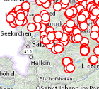
Punktuelle vegetationskundliche Erhebungen
Punktuell erfasste Flächen für die (vor allem vegetationskundliche) Einzelaufnahmen aus unterschiedlichen Quellen vorliegen, die der naturschutzfachlichen Bewertung dienen.
Simple
Metadata
- File identifier
- 08496702-4E84-435C-A340-5D37AF777E8D XML
- Metadata language
- de
- Character set
- UTF8
- Metadata standard name
-
OENORM A 2270
- Metadata standard version
-
Ausgabe 2016
- Date stamp
- 2026-04-01T08:08:51.546Z
- Metadata author
-
Organisation name Individual name Electronic mail address Role Amt der Oö. Landesregierung
HR, Mag., Günter, Dorninger
Point of contact
- Hierarchy level
- Dataset
- Dataset URI
-
H:\arcgis\Layerfiles\Fachschale_Naturschutz\punktuelle Erhebungen.lyr
Identification
- Alternate title
-
DORIS_U.GISDB.VWPUNKT_ERHEBUNGEN
- Date ( Creation)
- 1999-03-02
- Date ( Publication)
- 1999-03-02
- Point of contact
-
Organisation name Individual name Electronic mail address Role Amt der OÖ. Landesregierung
HR, Mag., Günter, Dorninger
Point of contact
Descriptive keywords
- OGD Kategorien ( Theme)
-
-
Umwelt
-
- OGD Keyword
-
-
Biologie
-
GENISYS
-
Natur
-
Naturschutz
-
- Keywords
-
-
Biologie
-
GENISYS
-
Natur
-
Naturschutz
-
Internetfreigabe
-
OGDFreigabe
-
Legal constraints
- Use limitation
-
no limitations
Legal constraints
- Access constraints
- Other restrictions
- Other constraints
-
Creative Commons Namensnennung 4.0 International (CC BY 4.0) https://creativecommons.org/licenses/by/4.0/deed.de
- Classification
- Unclassified
Technical information
- Denominator
- 1
- Metadata language
- de
- Character set
- UTF8
- Topic category
-
- Biota
Spatial Information
))
Temporal extent
Temporal extent
Data quality information
- Hierarchy level
- Dataset
- Statement
-
Die punktuellen vegetationskundlichen Erhebungen wurden auf Bais der ÖK 50 (Maßstab 1:50.000) digitalisiert.
Conformance result
- Date ( Publication)
- 1999-03-02
- Explanation
-
unbekannt
- Pass
- No
Reference System Information
- Projection
- EPSG:31255
Distribution Information
- Distribution format
-
Name Version Specification shapefile 1.0
ESRI Shapefile Technical Description
Overviews
Spatial extent
Provided by
