 DORIS Geodaten-Katalog
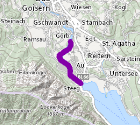
Gewässerstrecke mit besonderer ökologischer Funktion
Verordnung der Landeshauptmannes von OÖ als Regionalprogramm für besonders schützenswerte Gewässerstrecken
Simple
Metadata
- File identifier
- 0C5CD57D-9D41-4F92-969E-B0AEBE937379 XML
- Metadata language
- de
- Metadata standard name
-
OENORM A 2270
- Metadata standard version
-
Ausgabe 2016
- Date stamp
- 2026-03-17T15:38:41.14Z
- Metadata author
-
Organisation name Individual name Electronic mail address Role Amt der Oö. Landesregierung
DI, Edith, Wakolbinger
Point of contact
- Hierarchy level
- Dataset
- Dataset URI
-
H:\arcgis\Layerfiles\Umwelt\WIS\Regionalprogramme_Oberflaechengewaesser_besonders_schuetzenswerte_Gewaesserstrecken.lyrx
Identification
- Alternate title
-
DORIS_U.GISDB.EUWRR_BSW_GW_STRECKEN
- Date ( Creation)
- 2017-07-26
- Date ( Publication)
- 2017-07-26
- Date ( Revision)
- 2019-08-21
- Presentation form
- Digital map
- Point of contact
-
Organisation name Individual name Electronic mail address Role Amt der Oö. Landesregierung
DI, Norbert, Wohlschlager
Point of contact
Descriptive keywords
- OGD Kategorien ( Theme)
-
-
Umwelt
-
- OGD Keyword
-
-
Habitate
-
Lebensaum
-
Laichplatz
-
EUWRR
-
- Keywords
-
-
Habitate
-
Lebensaum
-
Laichplatz
-
EUWRR
-
Internetfreigabe
-
OGDFreigabe
-
Legal constraints
- Use limitation
-
no limitations
Legal constraints
- Access constraints
- Other restrictions
- Other constraints
-
Creative Commons Namensnennung 4.0 International (CC BY 4.0) https://creativecommons.org/licenses/by/4.0/deed.de
- Classification
- Unclassified
Technical information
- Spatial representation type
- Vector
- Denominator
- 1
- Metadata language
- de
- Character set
- UTF8
- Topic category
-
- Biota
- Environment
- Inland waters
Spatial Information
))
Temporal extent
Temporal extent
Data quality information
- Hierarchy level
- Dataset
- Statement
-
Grundlage für Verodnung des Regionalprogammes entsprechend dem nationalen Gewässerbewirtschaftsplan (NGP)
Conformance result
- Date ( Publication)
- 2017-07-26
- Explanation
-
keine
- Pass
- No
Reference System Information
- Projection
- EPSG:31255
Distribution Information
- Distribution format
-
Name Version Specification shapefile 1.0
ESRI Shapefile Technical Description
Overviews
Spatial extent
Provided by
