 DORIS Geodaten-Katalog
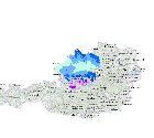
Schneehöhenmaximum 1981 bis 2010
mittleres jährliches Maximum der Gesamtschneehöhe im Zeitraum 1981 bis 2010
Simple
Metadata
- File identifier
- 0E945A3A-B41F-49F3-BC40-6D3B0BFECCAE XML
- Metadata language
- de
- Metadata standard name
-
OENORM A 2270
- Metadata standard version
-
Ausgabe 2016
- Date stamp
- 2026-01-19T09:39:41.102Z
- Metadata author
-
Organisation name Individual name Electronic mail address Role Amt der Oö. Landesregierung
Mag., MSc, Julia, Pichler
Point of contact
- Hierarchy level
- Dataset
- Dataset URI
-
H:\arcgis\Layerfiles\Umwelt\CLAIRISA\Schneehöhenmaximum 1981-2010.lyr
Identification
- Alternate title
-
DORIS_U.GISDB.SCHNEEHOEHE_MAXIMUM_JAHRESMITTEL_1981_2010_ZAMG
- Date ( Creation)
- 2015-12-15
- Date ( Publication)
- 2015-12-15
- Presentation form
- Digital map
- Point of contact
-
Organisation name Individual name Electronic mail address Role Amt der Oö. Landesregierung
Mag., Stefan, Oitzl
Point of contact
Descriptive keywords
- OGD Categories
-
-
Umwelt
-
- OGD Keyword
-
-
Schnee
-
Schneehöhe
-
- Keywords
-
-
Schnee
-
Schneehöhe
-
Internetfreigabe
-
OGDnoExport
-
Legal constraints
- Use limitation
-
no limitations
Legal constraints
- Access constraints
- Other restrictions
- Other constraints
-
Creative Commons Namensnennung 4.0 International (CC BY 4.0) https://creativecommons.org/licenses/by/4.0/deed.de
- Classification
- Unclassified
Technical information
- Spatial representation type
- Grid
- Denominator
- 1
- Metadata language
- de
- Character set
- UTF8
- Topic category
-
- Climatology, meteorology, atmosphere
- Environment
Spatial Information
))
Temporal extent
Temporal extent
Data quality information
- Hierarchy level
- Dataset
- Statement
-
Karte wurden im Zuge von CLAIRISA von der ZAMG erstellt. Die Karte muss nicht überarbeitet werden.
Conformance result
- Date ( Publication)
- 2015-12-15
- Explanation
-
keine
- Pass
- No
Reference System Information
- Projection
- EPSG:31255
Distribution Information
- Distribution format
-
Name Version Specification shapefile 1.0
ESRI Shapefile Technical Description
Overviews
Spatial extent
Provided by
