 DORIS Geodaten-Katalog
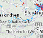
Hochwassertiefen Oberösterreich
Enthält prognostizierte Wassertiefe bei Hochwasser mit verschiedener Jährlichkeit. Das Aktualisierungsintervall ist unregelmäßig.
Simple
Metadata
- File identifier
- 140A1C27-205B-4591-970E-9101A8EA0B50 XML
- Metadata language
- de
- Character set
- UTF8
- Metadata standard name
-
OENORM A 2270
- Metadata standard version
-
Ausgabe 2016
- Date stamp
- 2026-07-13T05:20:52.744Z
- Metadata author
-
Organisation name Individual name Electronic mail address Role Amt der OÖ. Landesregierung
Prisca Heim BSc. MSc.
Point of contact
- Hierarchy level
- Dataset
- Dataset URI
-
H:\arcgis\Layerfiles\Umwelt\Geowissenschaften\HQ-Tiefe.lyr
Identification
- Alternate title
-
DORIS_U.GISDB.HQ_TIEFE
- Date ( Revision)
- 2026-05-26
- Date ( Publication)
- 2010-08-01
- Unique resource identifier
-
https://data.inspire.gv.at/0021/140A1C27-205B-4591-970E-9101A8EA0B50
- Point of contact
-
Organisation name Individual name Electronic mail address Role Amt der OÖ. Landesregierung
Stefan Hartinger
Point of contact
Descriptive keywords
- OGD Kategorien ( Theme)
-
-
Umwelt
-
- OGD Keyword
-
-
Wasserstand
-
Wassertiefe
-
Hochwasser
-
Regional
-
- Keywords
-
-
Wasserstand
-
Wassertiefe
-
Hochwasser
-
Regional
-
Internetfreigabe
-
OGDFreigabe
-
Legal constraints
- Use limitation
-
no limitations
Legal constraints
- Access constraints
- Other restrictions
- Other constraints
-
Creative Commons Namensnennung 4.0 International (CC BY 4.0) https://creativecommons.org/licenses/by/4.0/deed.de
- Classification
- Unclassified
Technical information
- Spatial representation type
- Vector
- Denominator
- 1
- Metadata language
- de
- Character set
- UTF8
- Topic category
-
- Environment
- Geoscientific information
- Inland waters
Spatial Information
))
Temporal extent
Temporal extent
Data quality information
- Hierarchy level
- Dataset
- Statement
-
Berechnungen von Zivilingenieuren für das Land OÖ; Datengrundlage: Hochwasserschätzungen, terrestrische Vermessung, Laserscan
Conformance result
- Date ( Publication)
- 2010-08-01
- Explanation
-
unbekannt
- Pass
- No
Reference System Information
- Projection
- EPSG:31255
Distribution Information
- Distribution format
-
Name Version Specification shapefile 1.0
ESRI Shapefile Technical Description
Overviews
Spatial extent
Provided by
