 DORIS Geodaten-Katalog
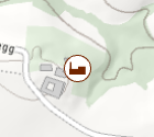
Biogasanlagen
Standorte der Biogasanlagen (Abfallvergärungsanlagen) in OÖ.
In Abfallvergärungsanlagen werden hauptsächlich betriebliche Küchen- und Speisereste, Altspeisefette, Abfälle aus der Futter-, Genuß- und Lebensmittelproduktion mit landwirtschaftlichen Abfällen (Ernterückstände, Fest- und Flüssigmist) vergoren und zur Wärme- und Stromerzeugung genutzt.
Simple
Metadata
- File identifier
- 1982039D-1822-4981-A3CC-D2C0DE612606 XML
- Metadata language
- de
- Character set
- UTF8
- Metadata standard name
-
OENORM A 2270
- Metadata standard version
-
Ausgabe 2016
- Date stamp
- 2026-03-02T06:09:53.867Z
- Metadata author
-
Organisation name Individual name Electronic mail address Role Amt der OÖ. Landesregierung
Mag., MSc, Julia, Pichler
Custodian
- Hierarchy level
- Dataset
- Dataset URI
-
H:\arcgis\Layerfiles\Umwelt\Ver_Entsorgung_Nachrichtenwesen\Biogasanlagen.lyrx
Identification
- Alternate title
-
DORIS_U.GISDB.BIOGASANLAGEN
- Date ( Revision)
- 2026-02-27
- Date ( Publication)
- 2024-12-03
- Edition
-
Version 1.0
- Point of contact
-
Organisation name Individual name Electronic mail address Role Amt der OÖ. Landesregierung
Andrea, Hörschläger
Point of contact
Descriptive keywords
- OGD Kategorien ( Theme)
-
-
Umwelt
-
- OGD Keyword
-
-
Abfallvergärung
-
Biogasanlagen
-
Biogas
-
Abfallvergärungsanlagen
-
- Keywords
-
-
Abfallvergärung
-
Biogasanlagen
-
Biogas
-
Abfallvergärungsanlagen
-
Internetfreigabe
-
OGDFreigabe
-
Legal constraints
- Use limitation
-
no limitations
Legal constraints
- Access constraints
- Other restrictions
- Other constraints
-
Creative Commons Namensnennung 4.0 International (CC BY 4.0) https://creativecommons.org/licenses/by/4.0/deed.de
- Classification
- Restricted
Technical information
- Denominator
- 1
- Metadata language
- de
- Character set
- UTF8
- Topic category
-
- Environment
- Utilities communication
Spatial Information
))
Temporal extent
Temporal extent
Data quality information
- Hierarchy level
- Dataset
- Statement
-
Anlagedaten aus AIS und EDM
Conformance result
- Date ( Creation)
- 2011-08-19
- Explanation
-
unbekannt
- Pass
- No
Reference System Information
- Projection
- EPSG:31255
Distribution Information
- Distribution format
-
Name Version Specification shapefile 1.0
ESRI Shapefile Technical Description
Overviews
Spatial extent
Provided by
