 DORIS Geodaten-Katalog
Landschaftserhebungen - Polygonabgrenzungen der Erhebungsflächen Oberösterreich
Abgrenzungen der auf Grund des Erhebungsmaßstabes 1:5000 als Polygone aufgenommenen Erhebungsflächen der in Oberösterreich durchgeführten Landschaftserhebungen mit Informationen zu Bestandestyp, Lage und Projekt.
Simple
Metadata
- File identifier
- 1D695A1A-F7B5-4360-940E-0F50335A715F XML
- Metadata language
- de
- Character set
- UTF8
- Metadata standard name
-
OENORM A 2270
- Metadata standard version
-
Ausgabe 2016
- Date stamp
- 2026-04-07T08:33:21.063Z
- Metadata author
-
Organisation name Individual name Electronic mail address Role Amt der OÖ. Landesregierung
HR, Mag., Günter, Dorninger
Point of contact
- Hierarchy level
- Dataset
- Dataset URI
-
H:\arcgis\Layerfiles\Umwelt\Biologie\Landschaftserhebung.lyr
Identification
- Alternate title
-
DORIS_U.GISDB.LANDSCHAFTSERHEBUNG_BESTANDTYP_POLY
- Date ( Publication)
- 2010-04-08
- Date ( Creation)
- 2010-04-07
- Date ( Revision)
- 2011-02-25
- Edition
-
Version 1.0
- Unique resource identifier
-
https://data.inspire.gv.at/0021/1D695A1A-F7B5-4360-940E-0F50335A715F
- Point of contact
-
Organisation name Individual name Electronic mail address Role Amt der OÖ. Landesregierung
HR, Mag., Günter, Dorninger
Point of contact
Descriptive keywords
- OGD Kategorien ( Theme)
-
-
Geographie und Planung
-
Umwelt
-
- OGD Keyword
-
-
Naturraumkartierung
-
Landschaftserhebung
-
- Keywords
-
-
Naturraumkartierung
-
Landschaftserhebung
-
Internetfreigabe
-
- Spatial scope
-
-
Regional
-
Legal constraints
- Use limitation
-
no limitations
Legal constraints
- Access constraints
- Other restrictions
- Other constraints
-
Creative Commons Namensnennung 4.0 International (CC BY 4.0) https://creativecommons.org/licenses/by/4.0/deed.de
- Classification
- Unclassified
Technical information
- Spatial representation type
- Vector
- Denominator
- 5000
- Metadata language
- de
- Character set
- UTF8
- Topic category
-
- Biota
- Planning cadastre
- Imagery base maps earth cover
Spatial Information
))
Temporal extent
Temporal extent
Data quality information
- Hierarchy level
- Dataset
- Statement
-
Abgrenzung der Erhebungsflächen auf der Basis digitales Orthophoto 1: 5000, zum Teil durch Orthohoto-Interpretation, zum Teil auf der Grundlage von Geländebegehungen
Conformance result
- Date ( Publication)
- 2010-12-08
- Explanation
-
unbekannt
- Pass
- No
Reference System Information
- Projection
- EPSG:31255
Distribution Information
- Distribution format
-
Name Version Specification shapefile 1.0
ESRI Shapefile Technical Description
Overviews
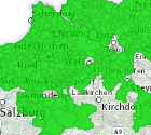
Spatial extent
Provided by
