 DORIS Geodaten-Katalog
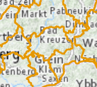
Pflichtsprengel Mittelschule
Ab dem Schuljahr 2017/2018 können alle 10- bis 14-jährigen Pflichtschüler/innen bzw. ihre Eltern oder sonstigen Erziehungsberechtigten in Oberösterreich selbst entscheiden, welche Mittelschule (MS) im Land sie besuchen wollen, sofern die räumlichen, personellen und organisatorischen Ressourcen am jeweiligen Wunschschulstandort dies zulassen.
Weiterhin kann aber jede Schülerin und jeder Schüler eine MS in unmittelbarer Wohnortnähe (Pflichtsprengelschule) besuchen. Schülerinnen und Schülern, die im Pflichtsprengel einer MS wohnen, darf auch in Zukunft die Aufnahme an dieser Schule nicht versagt werden.
Simple
Metadata
- File identifier
- 24C971CF-53EF-4432-A3FC-31259B6F9D6D XML
- Metadata language
- de
- Metadata standard name
-
OENORM A 2270
- Metadata standard version
-
Ausgabe 2016
- Date stamp
- 2026-01-19T09:40:29.64Z
- Metadata author
-
Organisation name Individual name Electronic mail address Role Amt der Oö. Landesregierung
Ing. Andreas Ennikl
Point of contact
- Hierarchy level
- Dataset
- Dataset URI
-
H:\arcgis\Layerfiles\BildungGesellschaft\Schulsprengel_NMS.lyr
Identification
- Alternate title
-
DORIS_BG.GISDB.SPRENGEL_MITTELSCHULEN
- Date ( Creation)
- 2017-01-01
- Date ( Publication)
- 2017-02-01
- Date ( Revision)
- 2026-01-05
- Presentation form
- Digital map
- Point of contact
-
Organisation name Individual name Electronic mail address Role Bildungsdirektion Oberösterreich
Julia Heiml
Point of contact
Descriptive keywords
- OGD Categories
-
-
Bildung und Forschung
-
- OGD Keyword
-
-
Schulsprengel
-
Mittelschule
-
- Keywords
-
-
Pflichtsprengel
-
Schulsprengel
-
Mittelschule
-
Internetfreigabe
-
OGDFreigabe
-
Legal constraints
- Use limitation
-
no limitations
Legal constraints
- Access constraints
- Other restrictions
- Other constraints
-
Creative Commons Namensnennung 4.0 International (CC BY 4.0) https://creativecommons.org/licenses/by/4.0/deed.de
- Classification
- Unclassified
Technical information
- Spatial representation type
- Vector
- Denominator
- 1
- Metadata language
- de
- Character set
- UTF8
- Topic category
-
- Boundaries
- Society
Spatial Information
))
Temporal extent
Temporal extent
Data quality information
- Hierarchy level
- Dataset
- Statement
-
Die Sprengelgrenzen werden von der Bildungsdirektion Oö. festgelegt.
Reference System Information
- Projection
- EPSG:31255
Distribution Information
- Distribution format
-
Name Version Specification shapefile 1.0
ESRI Shapefile Technical Description
Overviews
Spatial extent
Provided by
