 DORIS Geodaten-Katalog
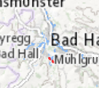
Gefahrenhinweiskarte für gravitative Massenbewegungen - Hinweisbereiche
Gefahrenhinweiskarte für gravitative Massenbewegungen. Geogenes Baugrundrisiko Phase II Hinweisbereiche.
Simple
- Alternate title
-
DORIS_PE.GISDB.GRII_HINWEISBEREICHE
- Date (Creation)
- 2013-01-07
- Date (Publication)
- 2013-01-07
- Date (Revision)
- 2025-06-27
- Citation identifier
- https://data.inspire.gv.at/0021/3270EB38-69B9-483E-9E05-380C43DB8365
- Point of contact
-
Organisation name Individual name Electronic mail address Role Amt der Oö. Landesregierung
HR Mag. Dr. Christoph Kolmer, MLBT
Point of contact
- Maintenance and update frequency
- Unknown
-
GEMET - Concepts, version 2.4
-
-
Gefahren
-
-
OGD Kategorien
-
-
Umwelt
-
Geographie und Planung
-
-
OGD Keyword
-
-
Umwelt
-
Geologisch
-
Boden
-
Bebauung
-
Bauwerke
-
Geowissenschaften
-
Gesellschaft
-
Wirtschaft
-
Georisiko
-
- Keywords
-
-
Umwelt
-
Geologisch
-
Boden
-
Bebauung
-
Bauwerke
-
Geowissenschaften
-
Gesellschaft
-
Wirtschaft
-
Georisiko
-
Internetfreigabe
-
OGDFreigabe
-
- Use constraints
- Other restrictions
- Other constraints
- Creative Commons Namensnennung 4.0 International (CC BY 4.0)
- Other constraints
-
Datenquelle: Land Oö., doris.at
- Access constraints
- Other restrictions
- Classification
- Unclassified
- Spatial representation type
- Vector
- Denominator
- 1
- Language
- Deutsch
- Character set
- UTF8
- Topic category
-
- Economy
- Society
- Environment
- Structure
- Geoscientific information
))
- Unique resource identifier
- EPSG:31255
- Geometric object type
- Surface
- Distribution format
-
Name Version ESRI Shapefile
1.0
- Distributor contact
-
Organisation name Individual name Electronic mail address Role Land Oberösterreich - Amt der OÖ- Landesregierung
Digital transfer options
- OnLine resource
-
Protocol Linkage Name https://e-gov.ooe.gv.at/at.gv.ooe.dorisdaten/DORIS_PE/GRII_HINWEISBEREICHE.zip
- Hierarchy level
- Dataset
- Statement
-
Die Daten wurden von der Oö. Boden- und Baustoffprüfstelle GmbH (BPS) und anderen Fachexperten erhoben.
Metadata
- File identifier
- 3270EB38-69B9-483E-9E05-380C43DB8365 XML
- Metadata language
- Deutsch
- Character set
- UTF8
- Hierarchy level
- Dataset
- Date stamp
- 2026-04-07T08:47:09.025Z
- Metadata standard name
-
ISO 19115:2003/19139
- Metadata standard version
-
1.0
- Metadata author
-
Organisation name Individual name Electronic mail address Role Amt der OÖ. Landesregierung
Mag., Peter, Sykora
Point of contact
- Dataset URI
-
H:\arcgis\Layerfiles\PlanungEntwicklung\Planungsunterlagen_Kastaster\Georisiko II Hinweisbereiche.lyr
Overviews
Spatial extent
Provided by
