 DORIS Geodaten-Katalog
Soildat
Parametererhebung und Aufbereitung bodenmechanischer Kennwerte für Lockergesteine in Oberösterreich
Simple
Metadata
- File identifier
- 32FB4BB9-85B4-468C-A73B-1F84EDB75B07 XML
- Metadata language
- de
- Metadata standard name
-
OENORM A 2270
- Metadata standard version
-
Ausgabe 2016
- Date stamp
- 2026-01-19T09:40:32.249Z
- Metadata author
-
Organisation name Individual name Electronic mail address Role Amt der Oö. Landesregierung
Mag., MSc, Julia, Pichler
Point of contact
- Hierarchy level
- Dataset
- Dataset URI
-
H:\arcgis\Layerfiles\Umwelt\Geowissenschaften\Soildat.lyr
Identification
- Alternate title
-
DORIS_U.GISDB.SOILDAT
- Date ( Creation)
- 2020-05-27
- Date ( Publication)
- 2022-11-17
- Point of contact
-
Organisation name Individual name Electronic mail address Role Amt der Oö. Landesregierung
HR Mag.Dr. Christoph Kolmer, MLBT
Point of contact
Descriptive keywords
- OGD Categories
-
-
Geographie und Planung
-
Umwelt
-
- OGD Keyword
-
-
Bodenmechanik
-
GIE
-
Solidat
-
- Keywords
-
-
Bodenmechanik
-
GIE
-
Soildat
-
Internetfreigabe
-
OGDFreigabe
-
Legal constraints
- Use limitation
-
no limitations
Legal constraints
- Access constraints
- Other restrictions
- Other constraints
-
Creative Commons Namensnennung 4.0 International (CC BY 4.0) https://creativecommons.org/licenses/by/4.0/deed.de
- Classification
- Unclassified
Technical information
- Spatial representation type
- Vector
- Denominator
- 1
- Metadata language
- de
- Character set
- UTF8
- Topic category
-
- Environment
- Geoscientific information
- Imagery base maps earth cover
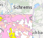
Spatial Information
N
S
E
W
))
Temporal extent
Temporal extent
Data quality information
- Hierarchy level
- Dataset
- Statement
-
Mitarbeit Oö. Boden- und Baustoffprüfstelle GmbH
Conformance result
- Date ( Creation)
- 2020-05-27
- Date ( Publication)
- 2022-11-17
- Explanation
-
keine Angabe
- Pass
- No
Reference System Information
- Projection
- EPSG:31255
Distribution Information
- Distribution format
-
Name Version Specification shapefile 1.0
ESRI Shapefile Technical Description
Overviews
Spatial extent
N
S
E
W
Provided by

Associated resources
Not available