 DORIS Geodaten-Katalog
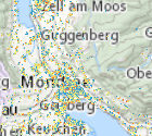
Jahressolarpotenzials pro Gebäude Mondseeland
"Statistische Analyse des
Jahressolarpotenzials pro Gebäude Attribute:
AREAPROJ: Summe der Rasterzellen mit Jahressumme des Solarpotenzials
>= 900 W/m²a innerhalb eines Gebäudepolygons * Fläche einer
Rasterzelle, Projektion der geeigneten Fläche auf die Horizontale
in m²
AREAREAL: reale, geneigte Fläche mit Jahressumme des Solarpotenzials
>= 900 W/m²a innerhalb eines Gebäudepolygons, berechnet als Summe
(Fläche eines Pixels / cos(Neigung des Pixels) in m²
MAX: höchster Wert der Jahressumme des Solarpotenzials innerhalb eines
Gebäudepolygons in W/m²a
MEAN: arithmetisches Mittel der Werte der Rasterzellen mit Jahressumme des
Solarpotenzials >= 900 W/m²a innerhalb eines Gebäudepolygons in W/m²a
STDDEV: Standardabweichung der Werte der Rasterzellen mit Jahressumme des
Solarpotenzials >= 900 W/m²a innerhalb eines Gebäudepolygons in W/m²a
(Vektordatensatz)"
Simple
Metadata
- File identifier
- 4B71EB88-F3AF-44BB-B21F-FAD0C034F1D5 XML
- Metadata language
- de
- Metadata standard name
-
OENORM A 2270
- Metadata standard version
-
Ausgabe 2016
- Date stamp
- 2026-01-19T09:28:48.038Z
- Metadata author
-
Organisation name Individual name Electronic mail address Role Amt der Oö. Landesregierung
Mag., MSc, Julia, Pichler
Point of contact
- Hierarchy level
- Dataset
- Dataset URI
-
H:\arcgis\Layerfiles\Umwelt\CLAIRISA\Solarpotential Mondseeland.lyr
Identification
- Alternate title
-
DORIS_U.GISDB.SOLARPOTENZIAL_GEBAEUDE_JAHR_MONDSEE
- Date ( Creation)
- 2017-05-15
- Date ( Publication)
- 2017-05-15
- Presentation form
- Digital map
- Point of contact
-
Organisation name Individual name Electronic mail address Role Amt der Oö. Landesregierung
Stefan, Oitzl
Point of contact
Descriptive keywords
- OGD Keyword
-
-
Solarpotenzial
-
Mondseeland
-
- Keywords
-
-
Solarpotenzial
-
Mondseeland
-
Internetfreigabe
-
OGDnoExport
-
Legal constraints
- Use limitation
-
no limitations
Legal constraints
- Access constraints
- Other restrictions
- Other constraints
-
Creative Commons Namensnennung 4.0 International (CC BY 4.0) https://creativecommons.org/licenses/by/4.0/deed.de
- Classification
- Unclassified
Technical information
- Spatial representation type
- Vector
- Denominator
- 1
- Metadata language
- de
- Character set
- UTF8
- Topic category
-
- Climatology, meteorology, atmosphere
- Environment
Spatial Information
))
Temporal extent
Temporal extent
Data quality information
- Hierarchy level
- Dataset
- Statement
-
Solarpotentialanalyse im Rahmen eines LEADER-Projektes Mondseeland
Conformance result
- Date ( Publication)
- 2017-05-15
- Explanation
-
keine
- Pass
- No
Reference System Information
- Projection
- EPSG:31255
Distribution Information
- Distribution format
-
Name Version Specification shapefile 1.0
ESRI Shapefile Technical Description
Overviews
Spatial extent
Provided by
