 DORIS Geodaten-Katalog
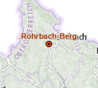
Bezirkshauptorte
Punktübersicht der 14 Bezirkshauptorte. Die mengenmäßige Differenz zu den Bezirken ergibt sich daraus, dass Linz-Land, Urfahr-Umgebung, Steyr-Land und Wels-Land die gleichen Bezirkshauptorte wie Linz, Steyr und Wels ausweisen
Simple
Metadata
- File identifier
- 4C0842BE-97C3-44B5-AD5F-5B536713A05C XML
- Metadata language
- de
- Character set
- UTF8
- Metadata standard name
-
OENORM A 2270
- Metadata standard version
-
Ausgabe 2016
- Date stamp
- 2026-03-23T06:36:55.764Z
- Metadata author
-
Organisation name Individual name Electronic mail address Role Amt der Oö. Landesregierung
MSc (GIS), Christoph, Kastl
Point of contact
- Hierarchy level
- Dataset
- Dataset URI
-
H:\arcgis\Layerfiles\DORIS_Basisdaten\Ortsangaben\Bezirkshauptorte.lyr
Identification
- Alternate title
-
DORIS_Basisdaten.GISDB.BEZIRKSHAUPTORTE_OOE
- Date ( Publication)
- 2002-01-01
- Date ( Creation)
- 2002-01-01
- Date ( Revision)
- 2007-01-01
- Point of contact
-
Organisation name Individual name Electronic mail address Role Amt der Oö. Landesregierung
MSc (GIS), Christoph, Kastl
Point of contact
Descriptive keywords
- OGD Kategorien ( Theme)
-
-
Geographie und Planung
-
Verwaltung und Politik
-
- OGD Keyword
-
-
Ortsangaben
-
- Keywords
-
-
Ortsangaben
-
Internetfreigabe
-
OGDFreigabe
-
Legal constraints
- Use limitation
-
no limitations
Legal constraints
- Access constraints
- Other restrictions
- Other constraints
-
Creative Commons Namensnennung 4.0 International (CC BY 4.0) https://creativecommons.org/licenses/by/4.0/deed.de
- Classification
- Unclassified
Technical information
- Denominator
- 1000000
- Metadata language
- de
- Character set
- UTF8
- Topic category
-
- Location
Spatial Information
))
Temporal extent
Temporal extent
Data quality information
- Hierarchy level
- Dataset
- Statement
-
Digitalisierung der Punktdaten auf Basis der ÖK. Nur für Übersichtszwecke geeignet.
Conformance result
- Date ( Creation)
- 2010
- Explanation
-
unbekannt
- Pass
- No
Reference System Information
- Projection
- EPSG:31255
Distribution Information
- Distribution format
-
Name Version Specification shapefile 1.0
ESRI Shapefile Technical Description
Overviews
Spatial extent
Provided by
