 DORIS Geodaten-Katalog
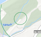
GW Trauntal Tiefststand 2010
Hydrogeologische Kategorisierung ?GW-Daten bzw. -standsplan Trauntal? (Quelle: Energie-AG).
Simple
Metadata
- File identifier
- 4EE99BAD-01D5-4FE6-B43E-F204B1831610 XML
- Metadata language
- de
- Metadata standard name
-
OENORM A 2270
- Metadata standard version
-
Ausgabe 2016
- Date stamp
- 2026-03-24T10:08:42.547Z
- Metadata author
-
Organisation name Individual name Electronic mail address Role Amt der Oö. Landesregierung
Heim Prisca, BSc MSc
Point of contact
- Hierarchy level
- Dataset
- Dataset URI
-
H:\arcgis\Layerfiles\Umwelt\Geowissenschaften\GW-Tiefststand_Trauntal_2010.lyrx
Identification
- Alternate title
-
DORIS_U.GISDB.GW_TIEFSTSTAND_TRAUNTAL_2010
- Date ( Revision)
- 2025-06-17
- Date ( Publication)
- 2024-07-02
- Presentation form
- Digital map
- Point of contact
-
Organisation name Individual name Electronic mail address Role Amt der Oö. Landesregierung
Kolmer Christoph, Mag. Dr., MLBT, HR
Point of contact
Descriptive keywords
- OGD Kategorien ( Theme)
-
-
Umwelt
-
Geographie und Planung
-
- OGD Keyword
-
-
GW-Stand
-
GW-Linie
-
HGW
-
Grundwasser
-
- Keywords
-
-
GW-Stand
-
GW-Linie
-
HGW
-
Grundwasser
-
OGDFreigabe
-
Internetfreigabe
-
Legal constraints
- Use limitation
-
no limitations
Legal constraints
- Access constraints
- Other restrictions
- Other constraints
-
Creative Commons Namensnennung 4.0 International (CC BY 4.0) https://creativecommons.org/licenses/by/4.0/deed.de
- Classification
- Unclassified
Technical information
- Spatial representation type
- Vector
- Denominator
- 1
- Metadata language
- de
- Character set
- UTF8
- Topic category
-
- Elevation
- Environment
- Geoscientific information
- Inland waters
Spatial Information
))
Temporal extent
Temporal extent
Data quality information
- Hierarchy level
- Dataset
- Statement
-
Projekt GeoloGIS 2021; GeoSphere Austria
Conformance result
- Date ( Creation)
- 2024-07-02
- Date ( Publication)
- 2024-07-02
- Explanation
-
keine Angabe
- Pass
- No
Reference System Information
- Projection
- EPSG:31255
Distribution Information
- Distribution format
-
Name Version Specification shapefile 1.0
ESRI Shapefile Technical Description
Overviews
Spatial extent
Provided by
