 DORIS Geodaten-Katalog
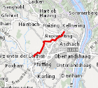
Regionale Siedlungsgrenzen
Darstellung der im regionalen Raumordnungsprogramm für die Region Eferding (LGBl. 84/2023) festgelegten regional bedeutenden Siedlungsgrenzen: Legt in Bereichen mit hohem Siedlungsdruck die überörtlich bedeutenden Baulandaußengrenzen fest. Diese dürfen bei der Neuwidmung von Bauland nicht
überschritten werden.
Simple
Metadata
- File identifier
- 4EF7D8AA-F3B0-4C66-A5D6-F368C2072728 XML
- Metadata language
- de
- Metadata standard name
-
OENORM A 2270
- Metadata standard version
-
Ausgabe 2016
- Date stamp
- 2026-04-01T08:50:55.069Z
- Metadata author
-
Organisation name Individual name Electronic mail address Role Amt der Oö. Landesregierung
Yeliz, Yildiz
Point of contact
- Hierarchy level
- Dataset
- Dataset URI
-
H:\arcgis\Layerfiles\PlanungEntwicklung\Planungsunterlagen_Kastaster\Regionale_Siedlungsgrenzen.lyrx
Identification
- Alternate title
-
DORIS_PE.GISDB.REGIONALE_SIEDLUNGSGRENZEN
- Date ( Publication)
- 2023-12-06
- Point of contact
-
Organisation name Individual name Electronic mail address Role Amt der Oö. Landesregierung
DI Andreas Mandlbauer
Point of contact
Descriptive keywords
- OGD Kategorien ( Theme)
-
-
Geographie und Planung
-
- OGD Keyword
-
-
Landesplanung
-
Raumordnung
-
Raumplanung
-
ogd
-
- Keywords
-
-
Landesplanung
-
Raumordnung
-
Raumplanung
-
Internetfreigabe
-
OGDFreigabe
-
Legal constraints
- Use limitation
-
no limitations
Legal constraints
- Access constraints
- Other restrictions
- Other constraints
-
Creative Commons Namensnennung 4.0 International (CC BY 4.0) https://creativecommons.org/licenses/by/4.0/deed.de
- Classification
- Unclassified
Technical information
- Spatial representation type
- Vector
- Denominator
- 1
- Metadata language
- de
- Character set
- UTF8
- Topic category
-
- Planning cadastre
Spatial Information
))
Temporal extent
Temporal extent
Data quality information
- Hierarchy level
- Dataset
- Statement
-
Datengrundlage für die Verordnung der Oö. Landesregierung betreffend das regionale Raumordnungsprogramm für die Region
Eferding 2 (LGBl. Nr. 84/2023). Dient lediglich zu Informationszwecken.
Conformance result
- Date ( Publication)
- 2023-12-06
- Explanation
-
keine Angabe
- Pass
- No
Reference System Information
- Projection
- EPSG:31255
Distribution Information
- Distribution format
-
Name Version Specification shapefile 1.0
ESRI Shapefile Technical Description
Overviews
Spatial extent
Provided by
