 DORIS Geodaten-Katalog
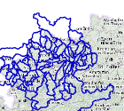
Haupteinzugsgebiete - Hauptgewässer
Einzugsgebiete sind durch Wasserscheiden abgegrenzte oberirdische Gebiete, aus denen Wasser ober- oder unterirdisch einem bestimmten Ort zufließt und dort als Durchfluss erfassbar ist. Bei den Haupteinzugsgebieten werden nur die Einzugsgebiete der Hauptgewässer dargestellt. Einzugsgebiete des gesamten Gewässernetz befinden sich im Layer Einzugsgebiete.
Dieser Datenbestand wird jährlich verbessert, wobei vorerst der Schwerpunkt in der Verbesserung der Benennung liegt.
Spaltenbeschreibung in eigenem Tabellenblatt!
Simple
Metadata
- File identifier
- 509DBFCA-96BE-4C50-A3D6-597CE4A7252E XML
- Metadata language
- de
- Character set
- UTF8
- Metadata standard name
-
OENORM A 2270
- Metadata standard version
-
Ausgabe 2016
- Date stamp
- 2026-01-19T09:29:00.415Z
- Metadata author
-
Organisation name Individual name Electronic mail address Role Amt der OÖ. Landesregierung
Mag., MSc, Julia, Pichler
Custodian
- Hierarchy level
- Dataset
- Dataset URI
-
H:\arcgis\Layerfiles\Umwelt\Binnengewässer\Haupteinzugsgebiete.lyr
Identification
- Alternate title
-
DORIS_U.GISDB.HAUPTEINZUGSGEBIETE
- Date ( Creation)
- 2004-01-01
- Date ( Publication)
- 2004-01-01
- Date ( Revision)
- 2022-08-10
- Edition
-
Version 1.0
- Point of contact
-
Organisation name Individual name Electronic mail address Role Amt der OÖ. Landesregierung
DI, Edith, Wakolbinger
Point of contact
Descriptive keywords
- OGD Categories
-
-
Geographie und Planung
-
Umwelt
-
- OGD Keyword
-
-
Fluss
-
Gewässer
-
- Keywords
-
-
Fluss
-
Gewässer
-
Internetfreigabe
-
OGDFreigabe
-
Legal constraints
- Use limitation
-
no limitations
Legal constraints
- Access constraints
- Other restrictions
- Other constraints
-
Creative Commons Namensnennung 4.0 International (CC BY 4.0) https://creativecommons.org/licenses/by/4.0/deed.de
- Classification
- Restricted
Technical information
- Denominator
- 500000
- Metadata language
- de
- Character set
- UTF8
- Topic category
-
- Climatology, meteorology, atmosphere
- Planning cadastre
- Geoscientific information
- Inland waters
Spatial Information
))
Temporal extent
Temporal extent
Data quality information
- Hierarchy level
- Dataset
- Statement
-
Aus den Detaileinzugsgebieten erstellte komulierte Einzugsgebiete für Flüsse mit einem Einzugsgebiet > 100 km2
Conformance result
- Date ( Publication)
- 2004-01-01
- Explanation
-
unbekannt
- Pass
- No
Reference System Information
- Projection
- EPSG:31255
Distribution Information
- Distribution format
-
Name Version Specification shapefile 1.0
ESRI Shapefile Technical Description
Overviews
Spatial extent
Provided by
