 DORIS Geodaten-Katalog
Klärschlamm Ausbringung
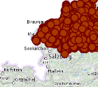
Lagemäßige Darstellung der landwirtschaftlichen Flächen auf denen zur Düngung geeigneter Klärschlamm verwendet wird, aufgeschlüsselt nach Jahren beginnend mit 2022. Jährliche Betrachtungen.
Simple
Metadata
- File identifier
- 631D7F9E-F454-4F1E-9264-191CD3083C6B XML
- Metadata language
- de
- Metadata standard name
-
OENORM A 2270
- Metadata standard version
-
Ausgabe 2016
- Date stamp
- 2026-01-19T09:29:41.337Z
- Metadata author
-
Organisation name Individual name Electronic mail address Role Amt der Oö. Landesregierung
Heim Prisca, BSc MSc
Point of contact
- Hierarchy level
- Dataset
- Dataset URI
-
H:\arcgis\Layerfiles\Umwelt\Landwirtschaft\Klaerschlamm_Ausbringung.lyrx
Identification
- Alternate title
-
DORIS_U.GISDB.KLAERSCHLAMM_AUSBRINGUNGEN
- Date ( Revision)
- 2025-09-01
- Date ( Publication)
- 2024-03-05
- Date ( Revision)
- 2025-01-09
- Presentation form
- Digital map
- Point of contact
-
Organisation name Individual name Electronic mail address Role Amt der Oö. Landesregierung
Wakolbinger Edith, Dipl.-Ing., HR
Point of contact
Descriptive keywords
- OGD Categories
-
-
Land- und Forstwirtschaft
-
Umwelt
-
- OGD Keyword
-
-
Klärschlamm
-
Ausbringung
-
- Keywords
-
-
Klärschlamm
-
Ausbringung
-
Internetfreigabe
-
OGDFreigabe
-
Legal constraints
- Use limitation
-
no limitations
Legal constraints
- Access constraints
- Other restrictions
- Other constraints
-
Creative Commons Namensnennung 4.0 International (CC BY 4.0) https://creativecommons.org/licenses/by/4.0/deed.de
- Classification
- Unclassified
Technical information
- Spatial representation type
- Vector
- Denominator
- 1
- Metadata language
- de
- Character set
- UTF8
- Topic category
-
- Farming
- Environment
Spatial Information
))
Temporal extent
Temporal extent
Data quality information
- Hierarchy level
- Dataset
- Statement
-
Abgrenzung auf Basis DKM (Stand 01.10.2023)
Conformance result
- Date ( Creation)
- 2024-03-05
- Date ( Publication)
- 2024-03-05
- Explanation
-
k.A.
- Pass
- No
Reference System Information
- Projection
- EPSG:31255
Distribution Information
- Distribution format
-
Name Version Specification shapefile 1.0
ESRI Shapefile Technical Description
Overviews
Spatial extent
Provided by
