 DORIS Geodaten-Katalog
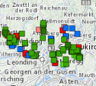
Gefahrenhinweiskarte 2.0 - Sturz
Aktualisierung der Gefahrenhinweiskarte für gravitative Massenbewegungen 2025
Simple
Metadata
- File identifier
- 63C9C1E9-A0F1-4254-A64A-F6C8BF56881D XML
- Metadata language
- de
- Metadata standard name
-
OENORM A 2270
- Metadata standard version
-
Ausgabe 2016
- Date stamp
- 2026-01-19T09:29:42.962Z
- Metadata author
-
Organisation name Individual name Electronic mail address Role Amt der Oö. Landesregierung
Mag., MSc, Julia, Pichler
Point of contact
- Hierarchy level
- Dataset
- Dataset URI
-
H:\arcgis\Layerfiles\Umwelt\Geowissenschaften\Ereigniskataster2.lyrx
Identification
- Alternate title
-
DORIS_U.GISDB.EREIGNISKATASTER2_STURZ
- Date ( Creation)
- 2025-06-01
- Date ( Publication)
- 2025-06-01
- Presentation form
- Digital map
- Point of contact
-
Organisation name Individual name Electronic mail address Role Amt der Oö. Landesregierung
Hans Kitzmüller, MSc
Point of contact
Descriptive keywords
- OGD Categories
-
-
Umwelt
-
- OGD Keyword
-
-
GHK
-
gravitative
-
Massenbewegungen
-
Karte
-
Phänomene
-
- Keywords
-
-
GHK
-
gravitative
-
Massenbewegungen
-
Karte
-
Phänomene
-
Internetfreigabe
-
OGDFreigabe
-
Legal constraints
- Use limitation
-
no limitations
Legal constraints
- Access constraints
- Other restrictions
- Other constraints
-
Creative Commons Namensnennung 4.0 International (CC BY 4.0) https://creativecommons.org/licenses/by/4.0/deed.de
- Classification
- Unclassified
Technical information
- Spatial representation type
- Vector
- Denominator
- 1
- Metadata language
- de
- Character set
- UTF8
- Topic category
-
- Economy
- Society
- Environment
- Structure
- Geoscientific information
Spatial Information
))
Temporal extent
Temporal extent
Data quality information
- Hierarchy level
- Dataset
- Statement
-
Daten stammen aus dem Projekt "GHK 2.0 Pilot". Mit diesem Projekt wurde eine Karte der Phänomene betr. gravitative Massenbewegungen geschaffen und die bestehende Gefahrenhinweiskarte sowie der Ereigniskataster aktualisiert.
Conformance result
- Date ( Creation)
- 2025-06-01
- Date ( Publication)
- 2025-06-01
- Explanation
-
keine Angabe
- Pass
- No
Reference System Information
- Projection
- EPSG:31255
Distribution Information
- Distribution format
-
Name Version Specification shapefile 1.0
ESRI Shapefile Technical Description
Overviews
Spatial extent
Provided by
