 DORIS Geodaten-Katalog
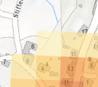
Standorträume für die Nah- und Fernwärmeversorgung (BOKU)
Die Standorträume für Nah- und Fernwärme stellen jene Siedlungsgebiete dar, die besonders effizient mit leitungsgebundener Wärme (und Kälte) versorgt werden können. Es werden jene Raum- und Siedlungsstrukturen ausgewiesen, die innerhalb einer Gemeinde einen Wärmebedarf erwarten lassen, der mit großer Wahrscheinlichkeit den wirtschaftlichen und effizienten Betrieb eines Nah- oder Fernwärmenetzes erlaubt.
Die Modellierung der Standorträume für Nah- und Fernwärme berücksichtigt die folgenden drei Parameter: (1) die Wärmebedarfsdichten, (2) die Verbraucherstruktur und (3) den Infrastrukturbedarf.
Stand der Daten: 2023. Nähere Informationen dazu finden Sie hier: https://www.land-oberoesterreich.gv.at/527850.htm
Simple
Metadata
- File identifier
- 76D2C21F-6772-4C84-A08D-47D75965AEDA XML
- Metadata language
- de
- Metadata standard name
-
OENORM A 2270
- Metadata standard version
-
Ausgabe 2016
- Date stamp
- 2026-01-19T09:30:18.759Z
- Metadata author
-
Organisation name Individual name Electronic mail address Role Amt der Oö. Landesregierung
Yeliz, Yildiz
Point of contact
- Hierarchy level
- Dataset
- Dataset URI
-
H:\arcgis\Layerfiles\PlanungEntwicklung\Planungsunterlagen_Kastaster\Standortraeume_Nah-Fernwaermeversorgung_BOKU.lyrx
Identification
- Alternate title
-
DORIS_PE.GISDB.STANDORTRAEUME_NAH_FERNWAERME
- Date ( Publication)
- 2023-12-06
- Presentation form
- Digital map
- Point of contact
-
Organisation name Individual name Electronic mail address Role Amt der Oö. Landesregierung
DI Michael Resch
Point of contact
Descriptive keywords
- OGD Categories
-
-
Geographie und Planung
-
- OGD Keyword
-
-
Energieraumplanung
-
- Keywords
-
-
Energieraumplanung
-
Internetfreigabe
-
OGDFreigabe
-
Legal constraints
- Use limitation
-
no limitations
Legal constraints
- Access constraints
- Other restrictions
- Other constraints
-
Creative Commons Namensnennung 4.0 International (CC BY 4.0) https://creativecommons.org/licenses/by/4.0/deed.de
- Classification
- Unclassified
Technical information
- Spatial representation type
- Grid
- Denominator
- 1
- Metadata language
- de
- Character set
- UTF8
- Topic category
-
- Planning cadastre
- Utilities communication
Spatial Information
))
Temporal extent
Temporal extent
Data quality information
- Hierarchy level
- Dataset
- Statement
-
Projekt "Energieraumplanung für Oberösterreichs Gemeinden", durchgeführt von der Universität für Bodenkultur Wien, Institut für Raumplanng, Umweltplanung und Bodenordnung im Auftrag der Abteilung Raumordnung des Landes OÖ
Conformance result
- Date ( Publication)
- 2023-12-06
- Explanation
-
keine Angabe
- Pass
- No
Reference System Information
- Projection
- EPSG:31255
Distribution Information
- Distribution format
-
Name Version Specification shapefile 1.0
ESRI Shapefile Technical Description
Overviews
Spatial extent
Provided by
