 DORIS Geodaten-Katalog
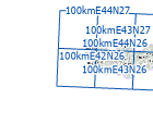
Referenzraster AT EEA 100 km
100 km Referenzraster für Österreich für naturschutzfachliche Erhebungen im europäischen Kontext basierend auf dem Referenzraster (Reference Grid) der Europäischen Umweltagentur (European Environment Agency)
Simple
Metadata
- File identifier
- 7CCA8D19-972A-4D97-8996-212E7C6D3F84 XML
- Metadata language
- de
- Metadata standard name
-
OENORM A 2270
- Metadata standard version
-
Ausgabe 2016
- Date stamp
- 2026-01-19T09:30:31.495Z
- Metadata author
-
Organisation name Individual name Electronic mail address Role Amt der Oö. Landesregierung
Mag., Günter, Dorninger
Point of contact
- Hierarchy level
- Dataset
- Dataset URI
-
H:\arcgis\Layerfiles\Umwelt\Biologie\Referenzraster_EEA_AT_100K.lyrx
Identification
- Alternate title
-
DORIS_U.GISDB.REFERENZRASTER_EEA_AT_100K
- Date ( Creation)
- 2023-07-15
- Date ( Publication)
- 2023-10-30
- Point of contact
-
Organisation name Individual name Electronic mail address Role Amt der Oö. Landesregierung
Mag., Günter, Dorninger
Point of contact
Descriptive keywords
- OGD Categories
-
-
Geographie und Planung
-
Umwelt
-
- OGD Keyword
-
-
Referenzraster
-
- Keywords
-
-
Referenzraster
-
OGDFreigabe
-
Internetfreigabe
-
Legal constraints
- Use limitation
-
no limitations
Legal constraints
- Access constraints
- Other restrictions
- Other constraints
-
Creative Commons Namensnennung 4.0 International (CC BY 4.0) https://creativecommons.org/licenses/by/4.0/deed.de
- Classification
- Unclassified
Technical information
- Spatial representation type
- Vector
- Denominator
- 1
- Metadata language
- de
- Character set
- UTF8
- Topic category
-
- Biota
- Elevation
- Environment
Spatial Information
))
Temporal extent
Temporal extent
Data quality information
- Hierarchy level
- Dataset
- Statement
-
basierend auf dem 100km Referenzraster (Reference Grid) der Europäischen Umweltagentur (European Environment Agency)
Conformance result
- Date ( Creation)
- 2023-07-15
- Date ( Publication)
- 2023-10-30
- Explanation
-
keine Angabe
- Pass
- No
Reference System Information
- Projection
- EPSG:31255
Distribution Information
- Distribution format
-
Name Version Specification shapefile 1.0
ESRI Shapefile Technical Description
Overviews
Spatial extent
Provided by
