 DORIS Geodaten-Katalog
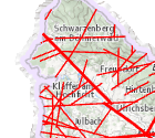
Lineamente 200
Großtektonik, Störungssysteme und Lineamentauswertungen in OÖ
Simple
Metadata
- File identifier
- 7DD604DF-A10B-48B3-9AB6-71996BCA8A58 XML
- Metadata language
- de
- Metadata standard name
-
OENORM A 2270
- Metadata standard version
-
Ausgabe 2016
- Date stamp
- 2026-05-13T10:22:42.033Z
- Metadata author
-
Organisation name Individual name Electronic mail address Role Amt der OÖ. Landesregierung
Mag., MSc, Julia, Pichler
Custodian
- Hierarchy level
- Dataset
- Dataset URI
-
H:\arcgis\Layerfiles\Umwelt\Geowissenschaften\Linamente\Lin_200_Lineament.lyr
Identification
- Alternate title
-
DORIS_U.GISDB.LINAMENTE200
- Date ( Creation)
- 2011-11-01
- Presentation form
- Digital map
- Point of contact
-
Organisation name Individual name Electronic mail address Role Amt der OÖ. Landesregierung
Mag., Harald, Schön
Point of contact
Descriptive keywords
- Keywords
-
-
Umwelt
-
Geologisch
-
Internetfreigabe
-
OGDFreigabe
-
Legal constraints
- Use limitation
-
no limitations
Legal constraints
- Access constraints
- Other restrictions
- Other constraints
-
Creative Commons Namensnennung 4.0 International (CC BY 4.0) https://creativecommons.org/licenses/by/4.0/deed.de
- Classification
- Unclassified
Technical information
- Spatial representation type
- Grid
- Denominator
- 200000
- Metadata language
- de
- Character set
- UTF8
- Topic category
-
- Environment
- Geoscientific information
Spatial Information
N
S
E
W
))
Temporal extent
Temporal extent
Data quality information
- Hierarchy level
- Dataset
- Statement
-
verschiedene Aufnahmemaßstäbe, Darstellung 1:20.000 und 1:200.000
Reference System Information
- Projection
- EPSG:31255
Overviews
Spatial extent
N
S
E
W
Provided by

Associated resources
Not available