 DORIS Geodaten-Katalog
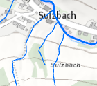
Detailgewässernetz
Im Detailgewässernetz sind Gewässer mit einem Einzugsgebiet größer 1 km2 erfasst. Hier sind auch jene Gewässer enthalten für die aufgrund der EU-Wasserrahmenrichtlinie keine Berichtspflicht besteht.
Simple
Metadata
- File identifier
- 80634C22-F961-444A-8B24-E7658BBDE6CD XML
- Metadata language
- de
- Character set
- UTF8
- Metadata standard name
-
OENORM A 2270
- Metadata standard version
-
Ausgabe 2016
- Date stamp
- 2026-01-19T09:30:38.136Z
- Metadata author
-
Organisation name Individual name Electronic mail address Role Amt der OÖ. Landesregierung
Mag., MSc, Julia, Pichler
Custodian
- Hierarchy level
- Dataset
- Dataset URI
-
H:\arcgis\Layerfiles\Umwelt\Binnengewässer\Detailgewässernetz.lyr
Identification
- Alternate title
-
DORIS_U.GISDB.DETAILGEWAESSERNETZ
- Date ( Revision)
- 2026-01-02
- Date ( Creation)
- 2004-01-01
- Date ( Publication)
- 2012-07-03
- Presentation form
- Digital map
- Point of contact
-
Organisation name Individual name Electronic mail address Role Amt der OÖ. Landesregierung
DI, Edith, Wakolbinger
Point of contact
Descriptive keywords
- OGD Categories
-
-
Umwelt
-
- OGD Keyword
-
-
Gewässer
-
Basisdaten
-
Wasser
-
Umwelt
-
- Keywords
-
-
Gewässer
-
Basisdaten
-
Wasser
-
Umwelt
-
Internetfreigabe
-
OGDFreigabe
-
Legal constraints
- Use limitation
-
no limitations
Legal constraints
- Access constraints
- Other restrictions
- Other constraints
-
Creative Commons Namensnennung 4.0 International (CC BY 4.0) https://creativecommons.org/licenses/by/4.0/deed.de
Security constraints
- Classification
- Restricted
- User note
-
nicht für generelle Auskunft/Offenlegung
Technical information
- Spatial representation type
- Vector
- Denominator
- 1
- Metadata language
- de
- Character set
- UTF8
- Topic category
-
- Environment
- Inland waters
Spatial Information
))
Temporal extent
Temporal extent
Data quality information
- Hierarchy level
- Dataset
- Statement
-
Die Datenwartung passiert durch das Land OÖ. Die Datengrundlage stammt vom Land OÖ. Die Daten sind für Routingaufgaben geeignet. Die Längen wurden geographisch berechnet und müssen den wahren Längen nicht entsprechen.
Reference System Information
- Projection
- EPSG:31255
Distribution Information
- Distribution format
-
Name Version Specification shapefile 1.0
ESRI Shapefile Technical Description
Overviews
Spatial extent
Provided by
