 DORIS Geodaten-Katalog
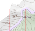
Blattschnitt DKM 2000
Enthält den Blattschnitt der DKM für den Maßstab 1:2000 (Kantenlänge der Kacheln: 1.250m x 1.000m)
Simple
Metadata
- File identifier
- 832C6D60-DAFF-4C72-A59A-6C47885EA4D5 XML
- Metadata language
- de
- Metadata standard name
-
OENORM A 2270
- Metadata standard version
-
Ausgabe 2016
- Date stamp
- 2026-03-23T06:35:49.545Z
- Metadata author
-
Organisation name Individual name Electronic mail address Role Amt der Oö. Landesregierung
MSc (GIS), Christoph, Kastl
Point of contact
- Hierarchy level
- Dataset
- Dataset URI
-
H:\arcgis\Layerfiles\DORIS_Basisdaten\Grenzen\DKM_Blattschnitt_2000.lyr
Identification
- Alternate title
-
DORIS_Basisdaten.GISDB.DKM_2000
- Date ( Publication)
- 2009-01-01
- Presentation form
- Digital map
- Point of contact
-
Organisation name Individual name Electronic mail address Role Amt der Oö. Landesregierung
MSc (GIS), Christoph, Kastl
Point of contact
Descriptive keywords
- OGD Kategorien ( Theme)
-
-
Geographie und Planung
-
- OGD Keyword
-
-
Planung und Kataster
-
Grenzen
-
Planungsunterlagen
-
- Keywords
-
-
Planung und Kataster
-
Grenzen
-
Planungsunterlagen
-
Internetfreigabe
-
OGDFreigabe
-
Legal constraints
- Use limitation
-
no limitations
Legal constraints
- Access constraints
- Other restrictions
- Other constraints
-
Creative Commons Namensnennung 4.0 International (CC BY 4.0) https://creativecommons.org/licenses/by/4.0/deed.de
- Classification
- Unclassified
Technical information
- Spatial representation type
- Vector
- Denominator
- 1
- Metadata language
- de
- Character set
- UTF8
- Topic category
-
- Boundaries
- Planning cadastre
Spatial Information
))
Temporal extent
Temporal extent
Data quality information
- Hierarchy level
- Dataset
- Statement
-
Datenimport des BEV-Blattschnittes
Conformance result
- Date ( Publication)
- 2009-01-01
- Explanation
-
keine Spezifikation
- Pass
- No
Reference System Information
- Projection
- EPSG:31255
Distribution Information
- Distribution format
-
Name Version Specification shapefile 1.0
ESRI Shapefile Technical Description
Overviews
Spatial extent
Provided by
