 DORIS Geodaten-Katalog
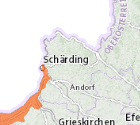
Beobachtungsgebiete nach QZV Chemie GW
In der QZV Chemie GW werden der gute chemische Zustand durch Schwellenwerte für Schadstoffe bezeichnet und Kriterien zur Beurteilung des chemischen Zustands im Grundwasser festgelegt. Weiters legt die Verordnung zum Schutz des Grundwassers vor Verschlechterung bzw. Verschmutzung Einbringungsverbote sowie -beschränkungen fest und bezeichnet die Kriterien für die Ausweisung von (Beobachtungs-) Gebieten gemäß § 33f WRG 1959 und gibt einen Rahmen für die Setzung von Maßnahmen vor.
Simple
Metadata
- File identifier
- 86B35579-0CF3-4E6D-8609-AFAE631EB383 XML
- Metadata language
- de
- Character set
- UTF8
- Metadata standard name
-
OENORM A 2270
- Metadata standard version
-
Ausgabe 2016
- Date stamp
- 2026-03-20T08:05:18.589Z
- Metadata author
-
Organisation name Individual name Electronic mail address Role Amt der OÖ. Landesregierung
Mag., MSc, Julia, Pichler
Custodian
- Hierarchy level
- Dataset
- Dataset URI
-
H:\arcgis\Layerfiles\Umwelt\Geowissenschaften\Beobachtungsgebiete_nach_QZV_Chemie_GW.lyrx
Identification
- Alternate title
-
DORIS_U.GISDB.GW_BEOBACHTUNGSGEBIET
- Date ( Revision)
- 2026-03-17
- Date ( Publication)
- 2007-09-12
- Presentation form
- Digital map
- Status
- Completed
- Point of contact
-
Organisation name Individual name Electronic mail address Role Amt der OÖ. Landesregierung
Dr., Franz, Überwimmer
Point of contact
Descriptive keywords
- OGD Kategorien ( Theme)
-
-
Umwelt
-
- OGD Keyword
-
-
Umwelt
-
Geologie und Boden
-
Geowissenschaften
-
- Keywords
-
-
Umwelt
-
Geologie und Boden
-
Geowissenschaften
-
Internetfreigabe
-
OGDFreigabe
-
Legal constraints
- Use limitation
-
no limitations
Legal constraints
- Access constraints
- Other restrictions
- Other constraints
-
Creative Commons Namensnennung 4.0 International (CC BY 4.0) https://creativecommons.org/licenses/by/4.0/deed.de
Security constraints
- Classification
- Restricted
- User note
-
Urheberrecht
Technical information
- Spatial representation type
- Vector
- Denominator
- 500
- Metadata language
- de
- Character set
- UTF8
- Topic category
-
- Environment
- Geoscientific information
Spatial Information
))
Temporal extent
Temporal extent
Data quality information
- Hierarchy level
- Dataset
- Statement
-
Pläne
Reference System Information
- Projection
- EPSG:31255
Distribution Information
- Distribution format
-
Name Version Specification shapefile 1.0
ESRI Shapefile Technical Description
Overviews
Spatial extent
Provided by
