 DORIS Geodaten-Katalog
RegioKat
Regionale Abfragemöglichkeit auf das Bibliothekssystem Adlib/OPAC der GSA (Geosphere Austria) unter Einbeziehung des RegioKat-Archivs der Abteilung Wasserwirtschaft.
Simple
Metadata
- File identifier
- 948FDFCB-1B5B-4E35-92A1-DFC8A1113A56 XML
- Metadata language
- de
- Character set
- UTF8
- Metadata standard name
-
OENORM A 2270
- Metadata standard version
-
Ausgabe 2016
- Date stamp
- 2026-01-19T09:31:12.467Z
- Metadata author
-
Organisation name Individual name Electronic mail address Role Amt der OÖ. Landesregierung
Mag., MSc, Julia, Pichler
Custodian
- Hierarchy level
- Dataset
- Dataset URI
-
H:\arcgis\Layerfiles\Umwelt\Umwelt\RegioKAT.lyrx
Identification
- Alternate title
-
DORIS_U.GISDB.REGIOKAT
- Date ( Publication)
- 2011-06-01
- Date ( Revision)
- 2024-01-30
- Edition
-
Version 1.0
- Point of contact
-
Organisation name Individual name Electronic mail address Role Amt der OÖ. Landesregierung
Mag. Dr., MLBT, HR, Christoph, Kolmer
Point of contact
Descriptive keywords
- OGD Categories
-
-
Geographie und Planung
-
- OGD Keyword
-
-
Bibliothek
-
Regionalkataster
-
GSA
-
- Keywords
-
-
Bibliothek
-
Regionalkataster
-
GSA
-
Internetfreigabe
-
OGDFreigabe
-
Legal constraints
- Use limitation
-
no limitations
Legal constraints
- Access constraints
- Other restrictions
- Other constraints
-
Creative Commons Namensnennung 4.0 International (CC BY 4.0) https://creativecommons.org/licenses/by/4.0/deed.de
- Classification
- Unclassified
Technical information
- Denominator
- 1
- Metadata language
- de
- Character set
- UTF8
- Topic category
-
- Boundaries
- Biota
- Planning cadastre
- Environment
- Geoscientific information
- Inland waters
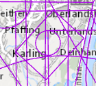
Spatial Information
))
Temporal extent
Temporal extent
Data quality information
- Hierarchy level
- Dataset
- Statement
-
Zusammenfassung von Bibliotheksinhalten von Wasserwirtschaft OÖ und GSA durch die GSA (Geosphere Austria, vormals GBA Geologische Bundesanstalt).
Reference System Information
- Projection
- EPSG:31255
Distribution Information
- Distribution format
-
Name Version Specification shapefile 1.0
ESRI Shapefile Technical Description
Overviews
Spatial extent
Provided by
