 DORIS Geodaten-Katalog
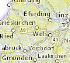
Photovoltaik-Freiflächen (Agro-PV) Prüffläche
Agro-PV-Anlagen auf geodatenverfügbaren Kriterien vorbehaltlich der Einzelfalllandschaftsbildbewertung. Es handelt sich hier um eine erste Grobeinschätzung welches ein Widmungsverfahren nicht präjudiziert. Abgebildet sind jene geodatenbasierten Kriterien gemäß Kriterienkatalog PV-Strategie für Agro-PV-Anlagen. Für Standard-PV-Anlagen im Nahebereich von Umspannwerken (und darüber hinaus) gelten die Kriterien gemäß Kriterienkatalog. Zur Simplifizierung wurde der Wald als Ausschlusszone übernommen. Hier gelten im Einzelfall die Kriterien gemäß Kriterienkatalog.
Simple
Metadata
- File identifier
- 9CE8CCF3-185B-422C-9A31-41854D583CA2 XML
- Metadata language
- de
- Metadata standard name
-
OENORM A 2270
- Metadata standard version
-
Ausgabe 2016
- Date stamp
- 2026-01-19T09:31:30.312Z
- Metadata author
-
Organisation name Individual name Electronic mail address Role Amt der Oö. Landesregierung
Prisca Heim
Point of contact
- Hierarchy level
- Dataset
- Dataset URI
-
H:\arcgis\Layerfiles\Umwelt\Umwelt\Photovoltaik_Freiflaechen.lyr
Identification
- Alternate title
-
DORIS_U.GISDB.PHOTOVOLTAIK_GUENSTIGE_BEREICHE
- Date ( Publication)
- 2022-09-20
- Date ( Creation)
- 2022-09-09
- Date ( Revision)
- 2022-12-06
- Presentation form
- Digital map
- Point of contact
-
Organisation name Individual name Electronic mail address Role Amt der Oö. Landesregierung
Nagl Michael
Point of contact
Descriptive keywords
- Keywords
-
-
Umspannwerke
-
Photovoltaik
-
Freifläche
-
Internetfreigabe
-
Legal constraints
- Use limitation
-
no limitations
Legal constraints
- Access constraints
- Other restrictions
- Other constraints
-
Creative Commons Namensnennung 4.0 International (CC BY 4.0) https://creativecommons.org/licenses/by/4.0/deed.de
- Classification
- Unclassified
Technical information
- Spatial representation type
- Vector
- Denominator
- 1
- Metadata language
- de
- Character set
- UTF8
- Topic category
-
- Environment
Spatial Information
))
Temporal extent
Temporal extent
Data quality information
- Hierarchy level
- Dataset
- Statement
-
Datensatz wurde auf Grundlage der Umspannwerke erzeugt. Die Urheberrechte der Umspannwerke liegen bei den verantwortlichen Netzbetreibern.
Conformance result
- Date ( Creation)
- 2022-09-09
- Date ( Publication)
- 2022-09-20
- Explanation
-
keine
- Pass
- No
Reference System Information
- Projection
- EPSG:31255
Distribution Information
- Distribution format
-
Name Version Specification shapefile 1.0
ESRI Shapefile Technical Description
Overviews
Spatial extent
Provided by
