 DORIS Geodaten-Katalog
Naturschutzfachliche Schutzgebiete mit Fördercode N2
Ausweisung von Europaschutz- und Naturschutzgebieten, in denen im ÖPUL der Fördercode N2 vergeben werden kann
Simple
Metadata
- File identifier
- ADBCDA06-E1CA-46BB-9EBF-5BD35DEDF7C3 XML
- Metadata language
- de
- Metadata standard name
-
OENORM A 2270
- Metadata standard version
-
Ausgabe 2016
- Date stamp
- 2026-01-19T09:31:56.437Z
- Metadata author
-
Organisation name Individual name Electronic mail address Role Amt der Oö. Landesregierung
Dipl.-Ing., Dr., Stefan, Reifeltshammer
Point of contact
- Hierarchy level
- Dataset
- Dataset URI
-
H:\arcgis\Layerfiles\Umwelt\Grenzen\Schutzgebiete_Foerdercode_N2.lyrx
Identification
- Alternate title
-
DORIS_U.GISDB.SCHUTZGEBIETE_FOERDERCODE_N2
- Date ( Creation)
- 2023-09-18
- Date ( Publication)
- 2023-10-16
- Presentation form
- Digital map
- Point of contact
-
Organisation name Individual name Electronic mail address Role Amt der Oö. Landesregierung
Dipl.-Ing., Dr., Stefan, Reifeltshammer
Point of contact
Descriptive keywords
- OGD Categories
-
-
Geographie und Planung
-
Land- und Forstwirtschaft
-
Umwelt
-
- OGD Keyword
-
-
Schutzgebiete
-
ÖPUL
-
Fördercode
-
- Keywords
-
-
Schutzgebiete
-
ÖPUL
-
Fördercode
-
OGDFreigabe
-
Internetfreigabe
-
Legal constraints
- Use limitation
-
no limitations
Legal constraints
- Access constraints
- Other restrictions
- Other constraints
-
Creative Commons Namensnennung 4.0 International (CC BY 4.0) https://creativecommons.org/licenses/by/4.0/deed.de
- Classification
- Unclassified
Technical information
- Spatial representation type
- Vector
- Denominator
- 1
- Metadata language
- de
- Character set
- UTF8
- Topic category
-
- Farming
- Biota
- Environment
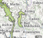
Spatial Information
))
Temporal extent
Temporal extent
Data quality information
- Hierarchy level
- Dataset
- Statement
-
laufende Erfassung
Conformance result
- Date ( Creation)
- 2023-09-18
- Date ( Publication)
- 2023-10-16
- Explanation
-
keine Angabe
- Pass
- No
Reference System Information
- Projection
- EPSG:31255
Distribution Information
- Distribution format
-
Name Version Specification shapefile 1.0
ESRI Shapefile Technical Description
Overviews
Spatial extent
Provided by
