 DORIS Geodaten-Katalog
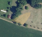
Gebiete mit erhöhtem Rohstoffpotential für Sande, Kiese und Tone
Darstellung der im regionalen Raumordnungsprogramm für die Region Eferding (LGBl. 84/2023) festgelegten Gebiete mit erhöhtem Rohstoffpotential für Sande, Kiese und Tone: Ein Bereich, der auf Grund seiner geogenen Voraussetzungen, vorhandener normativer Restriktionen sowie der Zielsetzungen dieser Verordnung für die künftige Gewinnung von Sanden, Kiesen und Tone eine potentiell erhöhte Eignung aufweist. Bei Umwidmungen innerhalb dieser Flächen ist eine Stellungnahme der Landesregierung einzuholen.
Simple
Metadata
- File identifier
- BC3885ED-17D4-47D2-9D15-1017419010DA XML
- Metadata language
- de
- Metadata standard name
-
OENORM A 2270
- Metadata standard version
-
Ausgabe 2016
- Date stamp
- 2026-01-19T09:32:27.907Z
- Metadata author
-
Organisation name Individual name Electronic mail address Role Amt der Oö. Landesregierung
Yeliz, Yildiz
Point of contact
- Hierarchy level
- Dataset
- Dataset URI
-
H:\arcgis\Layerfiles\PlanungEntwicklung\Planungsunterlagen_Kastaster\Gebiete_erhoehtem_Rohstoffpotential.lyrx
Identification
- Alternate title
-
DORIS_PE.GISDB.GEBIETE_ROHSTOFFPOTENTIAL
- Date ( Publication)
- 2023-12-06
- Presentation form
- Digital map
- Point of contact
-
Organisation name Individual name Electronic mail address Role Amt der Oö. Landesregierung
DI Andreas Mandlbauer
Point of contact
Descriptive keywords
- OGD Categories
-
-
Geographie und Planung
-
Wirtschaft und Tourismus
-
- OGD Keyword
-
-
Landesplanung
-
Raumordnung
-
Raumplanung
-
- Keywords
-
-
Landesplanung
-
Raumordnung
-
Raumplanung
-
Internetfreigabe
-
OGDFreigabe
-
Legal constraints
- Use limitation
-
no limitations
Legal constraints
- Access constraints
- Other restrictions
- Other constraints
-
Creative Commons Namensnennung 4.0 International (CC BY 4.0) https://creativecommons.org/licenses/by/4.0/deed.de
- Classification
- Unclassified
Technical information
- Spatial representation type
- Vector
- Denominator
- 1
- Metadata language
- de
- Character set
- UTF8
- Topic category
-
- Economy
- Planning cadastre
Spatial Information
))
Temporal extent
Temporal extent
Data quality information
- Hierarchy level
- Dataset
- Statement
-
Datengrundlage für die Verordnung der Oö. Landesregierung betreffend das regionale Raumordnungsprogramm für die Region
Eferding 2 (LGBl. Nr. 84/2023). Dient lediglich zu Informationszwecken.
Conformance result
- Date ( Publication)
- 2023-12-06
- Explanation
-
keine Angabe
- Pass
- No
Reference System Information
- Projection
- EPSG:31255
Distribution Information
- Distribution format
-
Name Version Specification shapefile 1.0
ESRI Shapefile Technical Description
Overviews
Spatial extent
Provided by
