 DORIS Geodaten-Katalog
GW Höchststände HGW 100
Qualitätssicherung bzw. Generierung der Modelle der Grundwasserhöchststände (?HGW 100?) für 3 GW-Teilgebiete (Linzer Feld, Welser Heide und Eferdinger Becken) mittels Pegeldaten (aus Zeitreihen durch das HZB ausgewählt und zur Verfügung gestellt) im Rahmen einer hydrogeologischen Validierung.
Simple
Metadata
- File identifier
- C82E053F-344A-432A-BC5D-65C956ED0058 XML
- Metadata language
- de
- Metadata standard name
-
OENORM A 2270
- Metadata standard version
-
Ausgabe 2016
- Date stamp
- 2026-01-19T09:32:47.035Z
- Metadata author
-
Organisation name Individual name Electronic mail address Role Amt der Oö. Landesregierung
Heim Prisca, BSc MSc
Point of contact
- Hierarchy level
- Dataset
- Dataset URI
-
H:\arcgis\Layerfiles\Umwelt\Geowissenschaften\GW-Hoechststaende_HGW_100_5m.lyrx
Identification
- Alternate title
-
DORIS_U.GISDB.GW_HOECHSTSTAENDE_HGW_100_5M
- Date ( Revision)
- 2025-06-17
- Date ( Publication)
- 2025-05-20
- Presentation form
- Digital map
- Point of contact
-
Organisation name Individual name Electronic mail address Role Amt der Oö. Landesregierung
Kolmer Christoph, Mag. Dr., MLBT, HR
Point of contact
Descriptive keywords
- OGD Categories
-
-
Geographie und Planung
-
Umwelt
-
- OGD Keyword
-
-
GW-Stand
-
GW-Linie
-
HGW
-
Grundwasser
-
- Keywords
-
-
GW-Stand
-
GW-Linie
-
HGW
-
Grundwasser
-
OGDFreigabe
-
Internetfreigabe
-
Legal constraints
- Use limitation
-
no limitations
Legal constraints
- Access constraints
- Other restrictions
- Other constraints
-
Creative Commons Namensnennung 4.0 International (CC BY 4.0) https://creativecommons.org/licenses/by/4.0/deed.de
- Classification
- Unclassified
Technical information
- Spatial representation type
- Vector
- Denominator
- 1
- Metadata language
- de
- Character set
- UTF8
- Topic category
-
- Elevation
- Environment
- Geoscientific information
- Inland waters
Spatial Information
))
Temporal extent
Temporal extent
Data quality information
- Hierarchy level
- Dataset
- Statement
-
Projekt GeoloGIS 2021; GeoSphere Austria
Conformance result
- Date ( Creation)
- 2024-07-02
- Date ( Publication)
- 2024-07-02
- Explanation
-
keine Angabe
- Pass
- No
Reference System Information
- Projection
- EPSG:31255
Distribution Information
- Distribution format
-
Name Version Specification shapefile 1.0
ESRI Shapefile Technical Description
Overviews
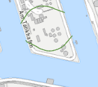
Spatial extent
Provided by
