 DORIS Geodaten-Katalog
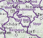
Pfarrgrenzen Evangelisch
Die Grundlage für deren Festsetzung der evangelischen Pfarrgemeinden bilden die Informationen der Evang. Superintendentur A.B. Oberösterreich.
Simple
Metadata
- File identifier
- CBDA2827-EECB-40F1-AB3B-AD118A9FEF0D XML
- Metadata language
- de
- Metadata standard name
-
OENORM A 2270
- Metadata standard version
-
Ausgabe 2016
- Date stamp
- 2026-01-19T09:32:52.848Z
- Metadata author
-
Organisation name Individual name Electronic mail address Role Amt der Oö. Landesregierung
Ing. Andreas Ennikl
Point of contact
- Hierarchy level
- Dataset
- Dataset URI
-
H:\arcgis\Layerfiles\Kultur\Grenzen\evang. Pfarrgemeinden.lyr
Identification
- Alternate title
-
DORIS_K.GISDB.EVANGELISCHE_PFARRGRENZEN
- Date ( Creation)
- 2013-01-01
- Date ( Publication)
- 2013-09-11
- Date ( Revision)
- 2024-06-13
- Presentation form
- Digital map
- Point of contact
-
Organisation name Individual name Electronic mail address Role Evang. Superintendentur A.B. Oberösterreich
Superintendent, Dr., Gerold, Lehner
Owner
Descriptive keywords
- GEMET - INSPIRE themes, version 1.0
-
-
Soziale Aspekte
-
Bevölkerung
-
- OGD Categories
-
-
Gesellschaft und Soziales
-
- OGD Keyword
-
-
Basisdaten
-
Grenzen
-
Gesellschaft
-
Ortsangaben
-
- Keywords
-
-
Basisdaten
-
Grenzen
-
Gesellschaft
-
Ortsangaben
-
Internetfreigabe
-
OGDFreigabe
-
Legal constraints
- Use limitation
-
no limitations
Legal constraints
- Access constraints
- Other restrictions
- Other constraints
-
Creative Commons Namensnennung 4.0 International (CC BY 4.0) https://creativecommons.org/licenses/by/4.0/deed.de
- Classification
- Unclassified
Technical information
- Spatial representation type
- Vector
- Denominator
- 500000
- Metadata language
- de
- Character set
- UTF8
- Topic category
-
- Boundaries
- Society
- Location
- Utilities communication
Spatial Information
))
Temporal extent
Temporal extent
Data quality information
- Hierarchy level
- Dataset
- Statement
-
Evang. Superintendentur A.B. Oberösterreich
Conformance result
- Date ( Creation)
- 2013-01-01
- Date ( Publication)
- 2013-09-11
- Date ( Revision)
- 2014-01-01
- Date ( Revision)
- 2015-02-05
- Explanation
-
unbekannt
- Pass
- No
Reference System Information
- Projection
- EPSG:31255
Distribution Information
- Distribution format
-
Name Version Specification shapefile 1.0
ESRI Shapefile Technical Description
Overviews
Spatial extent
Provided by
