 DORIS Geodaten-Katalog
Geosignaturen Punkte
Erdwissenschaftliche Informationen; Punkteinträge. Informationen über Massenbewegungen.
Simple
Metadata
- File identifier
- CDC009A3-103C-438F-B77D-802E33F755AA XML
- Metadata language
- de
- Metadata standard name
-
OENORM A 2270
- Metadata standard version
-
Ausgabe 2016
- Date stamp
- 2026-01-19T09:32:57.379Z
- Metadata author
-
Organisation name Individual name Electronic mail address Role Amt der Oö. Landesregierung
Mag., MSc, Julia, Pichler
Point of contact
- Hierarchy level
- Dataset
- Dataset URI
-
H:\arcgis\Layerfiles\Umwelt\Geowissenschaften\Geosignaturen.lyr
Identification
- Alternate title
-
DORIS_U.GISDB.GEOSIGNATUR_GK_20_PUNKT
- Date ( Creation)
- 2019-03-05
- Date ( Publication)
- 2022-11-17
- Point of contact
-
Organisation name Individual name Electronic mail address Role Amt der Oö. Landesregierung
HR Mag.Dr. Christoph Kolmer, MLBT
Point of contact
Descriptive keywords
- OGD Categories
-
-
Geographie und Planung
-
Umwelt
-
- OGD Keyword
-
-
Geosignatur
-
Erdwissenschaft
-
Massenbewegungen
-
GK20
-
- Keywords
-
-
Geosignatur
-
Erdwissenschaft
-
Massenbewegungen
-
GK20
-
Internetfreigabe
-
OGDFreigabe
-
Legal constraints
- Use limitation
-
no limitations
Legal constraints
- Access constraints
- Other restrictions
- Other constraints
-
Creative Commons Namensnennung 4.0 International (CC BY 4.0) https://creativecommons.org/licenses/by/4.0/deed.de
- Classification
- Unclassified
Technical information
- Spatial representation type
- Vector
- Denominator
- 1
- Metadata language
- de
- Character set
- UTF8
- Topic category
-
- Environment
- Geoscientific information
- Imagery base maps earth cover
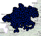
Spatial Information
))
Temporal extent
Temporal extent
Data quality information
- Hierarchy level
- Dataset
- Statement
-
Erstellung durch GBA Wien
Conformance result
- Date ( Creation)
- 2019-03-05
- Date ( Publication)
- 2022-11-17
- Explanation
-
keine Angabe
- Pass
- No
Reference System Information
- Projection
- EPSG:31255
Distribution Information
- Distribution format
-
Name Version Specification shapefile 1.0
ESRI Shapefile Technical Description
Overviews
Spatial extent
Provided by
