 DORIS Geodaten-Katalog
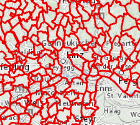
Gemeindegrenzen OÖ
Abgrenzung der politischen Gemeinden auf Basis der DKM. Die politische Gemeinde entspricht einer Verwaltungseinheit innerhalb eines politischen Bezirks.
Stand: 01.04.2025
Simple
Metadata
- File identifier
- CDF6A05E-422A-4DC4-A51A-BEBE4FD5C0AE XML
- Metadata language
- de
- Character set
- UTF8
- Metadata standard name
-
OENORM A 2270
- Metadata standard version
-
Ausgabe 2016
- Date stamp
- 2026-05-13T10:18:31.204Z
- Metadata author
-
Organisation name Individual name Electronic mail address Role Amt der Oö. Landesregierung
MSc (GIS), Christoph, Kastl
Point of contact
- Hierarchy level
- Dataset
- Dataset URI
-
H:\arcgis\Layerfiles\DORIS_Basisdaten\Grenzen\Gemeindegrenzen.lyr
Identification
- Alternate title
-
DORIS_Basisdaten.GISDB.GEMEINDEGRENZEN_OOE
- Date ( Publication)
- 2008-03-13
- Date ( Creation)
- 2008-03-13
- Date ( Revision)
- 2025-10-01
- Point of contact
-
Organisation name Individual name Electronic mail address Role Amt der Oö. Landesregierung
MSc (GIS), Christoph, Kastl
Point of contact
Descriptive keywords
- OGD Kategorien ( Theme)
-
-
Verwaltung und Politik
-
Geographie und Planung
-
- OGD Keyword
-
-
Basisdaten
-
- Keywords
-
-
Basisdaten
-
Internetfreigabe
-
OGDFreigabe
-
Legal constraints
- Use limitation
-
no limitations
Legal constraints
- Access constraints
- Other restrictions
- Other constraints
-
Creative Commons Namensnennung 4.0 International (CC BY 4.0) https://creativecommons.org/licenses/by/4.0/deed.de
- Classification
- Unclassified
Technical information
- Denominator
- 1
- Metadata language
- de
- Character set
- UTF8
- Topic category
-
- Boundaries
Spatial Information
))
Temporal extent
Temporal extent
Data quality information
- Hierarchy level
- Dataset
- Statement
-
Die Abgrenzung erfolgte auf Basis der DKM des Bundesamtes für Eich- und Vermessungswesen (BEV).
Conformance result
- Explanation
-
unbekannt
- Pass
- No
Reference System Information
- Projection
- EPSG:31255
Distribution Information
- Distribution format
-
Name Version Specification shapefile 1.0
ESRI Shapefile Technical Description
Overviews
Spatial extent
Provided by
