 DORIS Geodaten-Katalog
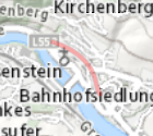
Tunnelschutzzonen
"Tunnelschutzzonen definieren einen Bereich, innerhalb diesem bestimmte bauliche Einschränkungen einzuhalten sind. Tunnelschutzzone I:
Innerhalb dieses Schutzbereiches sind Tiefenbohrungen und Versickerungsanlagen unzulässig. Der Neu-, Zu- und Umbau von Gebäuden und baulichen Anlagen ist nur mit Zustimmung der Landesstraßenverwaltung zulässig. Tunnelschutzzone II:
Innerhalb dieses Schutzbereiches sind Tiefenbohrungen, Versickerungsanlagen und die Errichtung von Gebäuden und baulichen Anlagen unzulässig."
Simple
Metadata
- File identifier
- D4C9D5A2-05CE-47F7-A8B8-EAD5A20287D6 XML
- Metadata language
- de
- Metadata standard name
-
OENORM A 2270
- Metadata standard version
-
Ausgabe 2016
- Date stamp
- 2026-01-19T09:33:08.662Z
- Metadata author
-
Organisation name Individual name Electronic mail address Role Amt der Oö. Landesregierung
Bruno, Standhartinger
Point of contact
- Hierarchy level
- Dataset
- Dataset URI
-
H:\arcgis\Layerfiles\Verkehr\Verkehrswesen\Tunnelschutzzonen.lyr
Identification
- Alternate title
-
DORIS_V.GISDB.TUNNELSCHUTZZONEN
- Date ( Creation)
- 2018-09-05
- Date ( Publication)
- 2018-09-05
- Date ( Revision)
- 2022-01-27
- Presentation form
- Digital map
- Point of contact
-
Organisation name Individual name Electronic mail address Role Amt der Oö. Landesregierung
Ing., Peter, Frischauf
Point of contact
Descriptive keywords
- OGD Categories
-
-
Verkehr und Technik
-
- OGD Keyword
-
-
Tunnel
-
Schutzzone
-
Pufferzone
-
- Keywords
-
-
Tunnel
-
Schutzzone
-
Pufferzone
-
Internetfreigabe
-
OGDFreigabe
-
Legal constraints
- Use limitation
-
no limitations
Legal constraints
- Access constraints
- Other restrictions
- Other constraints
-
Creative Commons Namensnennung 4.0 International (CC BY 4.0) https://creativecommons.org/licenses/by/4.0/deed.de
- Classification
- Unclassified
Technical information
- Spatial representation type
- Vector
- Denominator
- 1
- Metadata language
- de
- Character set
- UTF8
- Topic category
-
- Transportation
Spatial Information
))
Temporal extent
Temporal extent
Data quality information
- Hierarchy level
- Dataset
- Statement
-
k.A.
Conformance result
- Date ( Publication)
- 2018-09-05
- Explanation
-
keine
- Pass
- No
Reference System Information
- Projection
- EPSG:31255
Distribution Information
- Distribution format
-
Name Version Specification shapefile 1.0
ESRI Shapefile Technical Description
Overviews
Spatial extent
Provided by
