 DORIS Geodaten-Katalog
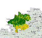
Hangneigung als 5m-Raster (in Grad)
Hangneigung als 5m-Raster in Grad; gerechnet aus dem digitalen Geländemodell, abgeleitet aus den aktuellsten Airborne Laserscanning (ALS) Befliegungen.
Simple
Metadata
- File identifier
- D67FCB0B-5B07-45E8-8FC5-CF0F8D92FD0B XML
- Metadata language
- de
- Character set
- UTF8
- Metadata standard name
-
OENORM A 2270
- Metadata standard version
-
Ausgabe 2016
- Date stamp
- 2026-04-24T07:43:31.865Z
- Metadata author
-
Organisation name Individual name Electronic mail address Role Amt der Oö. Landesregierung
MSc, Kosar Bernhard
Point of contact
- Hierarchy level
- Dataset
- Dataset URI
-
H:\arcgis\Layerfiles\DORIS_Rasterdaten\Hangneigung_5m_Grad.lyrx
Identification
- Alternate title
-
DORIS_RASTERDATEN.GISDB.HANGNEIGUNG_GRAD_5M
- Date ( Creation)
- 2013-11-19
- Date ( Publication)
- 2013-11-19
- Date ( Revision)
- 2026-04-24
- Purpose
-
Wurde vorwiegend für die Wintersportapplikation im interMap erzeugt
- Status
- Completed
- Point of contact
-
Organisation name Individual name Electronic mail address Role Amt der OÖ. Landesregierung
MSc, MPA, MBA, Christian, Greifeneder
Point of contact
Descriptive keywords
- OGD Kategorien ( Theme)
-
-
Wirtschaft und Tourismus
-
Sport und Freizeit
-
Geographie und Planung
-
- OGD Keyword
-
-
DHM
-
Hangneigung
-
- Keywords
-
-
DHM
-
Hangneigung
-
Internetfreigabe
-
OGDFreigabe
-
Legal constraints
- Use limitation
-
no limitations
Legal constraints
- Access constraints
- Other restrictions
- Other constraints
-
Creative Commons Namensnennung 4.0 International (CC BY 4.0) https://creativecommons.org/licenses/by/4.0/deed.de
- Classification
- Unclassified
Technical information
- Spatial representation type
- Grid
- Distance
- 10 m
- Metadata language
- de
- Character set
- UTF8
- Topic category
-
- Economy
- Geoscientific information
- Imagery base maps earth cover
Spatial Information
))
Temporal extent
Temporal extent
Data quality information
- Hierarchy level
- Dataset
- Statement
-
Abgeleitet aus den aktuellsten Airborne Laserscanning (ALS) Befliegungen.
Conformance result
- Date ( Publication)
- 2013-11-19
- Explanation
-
unbekannt
- Pass
- No
Reference System Information
- Projection
- EPSG:31255
Distribution Information
- Distribution format
-
Name Version Specification shapefile 1.0
ESRI Shapefile Technical Description
Overviews
Spatial extent
Provided by
