 DORIS Geodaten-Katalog
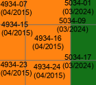
Blattschnitt DKM 2000 mit ALS-Befliegungsdatum (Letztstand)
DKM-2000 Blattschnitt mit Airborne Laserscanning Befliegungsdatum (Letztstand)
Simple
Metadata
- File identifier
- EE4BE212-B2DF-417F-B954-25BFCC4F06ED XML
- Metadata language
- de
- Metadata standard name
-
OENORM A 2270
- Metadata standard version
-
Ausgabe 2016
- Date stamp
- 2026-05-21T09:41:58.326Z
- Metadata author
-
Organisation name Individual name Electronic mail address Role Amt der Oö. Landesregierung
MSc, Bernhard, Kosar
Point of contact
- Hierarchy level
- Dataset
- Dataset URI
-
H:\arcgis\Layerfiles\DORIS_Basisdaten\Bilddaten\Status_Hoehenmodelle_Akt_Flugjahre.lyrx
Identification
- Alternate title
-
DORIS_Basisdaten.GISDB.HOEHENMODELL_AKTUELLE_FLUGJAHRE
- Date ( Creation)
- 2019-01-28
- Date ( Publication)
- 2019-01-28
- Date ( Revision)
- 2026-05-21
- Presentation form
- Digital map
- Point of contact
-
Organisation name Individual name Electronic mail address Role Amt der Oö. Landesregierung
MSc, Bernhard, Kosar
Point of contact
Descriptive keywords
- OGD Kategorien ( Theme)
-
-
Geographie und Planung
-
- OGD Keyword
-
-
ALS
-
DHM
-
DGM
-
DOM
-
Schummerung
-
Befliegungsdatum
-
Hangneigung
-
Hangrichtung
-
Geländemodell
-
Oberflächenmodell
-
Vegetationshöhen
-
Gebäudehöhen
-
Höhenmodell
-
- Keywords
-
-
ALS
-
DHM
-
DGM
-
DOM
-
Schummerung
-
Befliegungsdatum
-
Hangneigung
-
Hangrichtung
-
Geländemodell
-
Oberflächenmodell
-
Vegetationshöhen
-
Gebäudehöhen
-
Höhenmodell
-
Internetfreigabe
-
OGDFreigabe
-
Legal constraints
- Use limitation
-
no limitations
Legal constraints
- Access constraints
- Other restrictions
- Other constraints
-
Creative Commons Namensnennung 4.0 International (CC BY 4.0) https://creativecommons.org/licenses/by/4.0/deed.de
- Classification
- Unclassified
Technical information
- Spatial representation type
- Vector
- Denominator
- 1
- Metadata language
- de
- Character set
- UTF8
- Topic category
-
- Elevation
Spatial Information
))
Temporal extent
Temporal extent
Data quality information
- Hierarchy level
- Dataset
- Statement
-
laufende Erfassung
Conformance result
- Date ( Publication)
- 2019-01-28
- Explanation
-
keine
- Pass
- No
Reference System Information
- Projection
- EPSG:31255
Distribution Information
- Distribution format
-
Name Version Specification shapefile 1.0
ESRI Shapefile Technical Description
Overviews
Spatial extent
Provided by
