 DORIS Geodaten-Katalog
Gipfel der politischen Bezirke Oberösterreichs
Der Datensatz enthält die höchsten Gipfel bzw. Erhebungen der politischen Bezirke Oberösterreichs. Grundlage dafür sind Auswertungen aus der Höhendatenbank des Landes (Airborne-Laserscandaten).
Simple
Metadata
- File identifier
- EF1FB3D6-9D56-435A-A340-155425AC60EE XML
- Metadata language
- de
- Metadata standard name
-
OENORM A 2270
- Metadata standard version
-
Ausgabe 2016
- Date stamp
- 2026-01-19T09:34:03.35Z
- Metadata author
-
Organisation name Individual name Electronic mail address Role Amt der Oö. Landesregierung
Dipl.-Ing., (FH), Markus, Beyer
Point of contact
- Hierarchy level
- Dataset
- Dataset URI
-
H:\arcgis\Layerfiles\DORIS_Basisdaten\Ortsangaben\Höchste Punkte im Bezirk.lyr
Identification
- Alternate title
-
DORIS_Basisdaten.GISDB.GIPFEL_BEZIRKE
- Date ( Creation)
- 2013-07-01
- Date ( Publication)
- 2013-09-01
- Presentation form
- Digital map
- Point of contact
-
Organisation name Individual name Electronic mail address Role Amt der Oö. Landesregierung
Dipl.-Ing., (FH), Markus, Beyer
Point of contact
Descriptive keywords
- OGD Categories
-
-
Geographie und Planung
-
- OGD Keyword
-
-
Höheninformation
-
Geowissenschaften
-
Ortsangaben
-
- Keywords
-
-
Höheninformation
-
Geowissenschaften
-
Ortsangaben
-
Internetfreigabe
-
OGDFreigabe
-
Legal constraints
- Use limitation
-
no limitations
Legal constraints
- Access constraints
- Other restrictions
- Other constraints
-
Creative Commons Namensnennung 4.0 International (CC BY 4.0) https://creativecommons.org/licenses/by/4.0/deed.de
- Classification
- Unclassified
Technical information
- Spatial representation type
- Grid
- Denominator
- 1
- Metadata language
- de
- Character set
- UTF8
- Topic category
-
- Elevation
- Geoscientific information
- Location
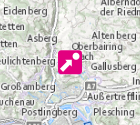
Spatial Information
))
Temporal extent
Temporal extent
Data quality information
- Hierarchy level
- Dataset
- Statement
-
abgleitet aus ALS-Daten
Reference System Information
- Projection
- EPSG:31255
Distribution Information
- Distribution format
-
Name Version Specification shapefile 1.0
ESRI Shapefile Technical Description
Overviews
Spatial extent
Provided by
