 DORIS Geodaten-Katalog
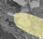
Herkunftsgebiete Alpenvorland
Lage und Höhe der Herkunftsgebiete im Alpenvorland und Gebirge des Saatgutes für die Forstwirtschaft. Rechtl. Grundlage ist die Forstliche Vermehrungsgutverordnung 2002 und die Verordnung Forstliches Vermehrungsgut BGBl.Nr. 512/1996 ST0163.
Simple
Metadata
- File identifier
- F4981C83-5F8F-4793-BC57-B1408034F376 XML
- Metadata language
- de
- Character set
- UTF8
- Metadata standard name
-
OENORM A 2270
- Metadata standard version
-
Ausgabe 2016
- Date stamp
- 2026-03-23T15:51:33.553Z
- Metadata author
-
Organisation name Individual name Electronic mail address Role Amt der Oö. Landesregierung
Dipl.-Ing., Roland, Paumann
Point of contact
- Hierarchy level
- Dataset
- Dataset URI
-
H:\arcgis\Layerfiles\PlanungEntwicklung\Grenzen\Herkunftsgebiete Alpenvorland.lyr
Identification
- Alternate title
-
DORIS_PE.GISDB.HERKUNFTSGEBIETE_AV
- Date ( Publication)
- 2008-09-12
- Date ( Creation)
- 2008-01-01
- Date ( Revision)
- 2008-09-12
- Point of contact
-
Organisation name Individual name Electronic mail address Role Landesregierung Oberösterreich, Abteilung Land- und Forstwirtschaft
Dipl.-Ing., Roland, Paumann
Point of contact
Descriptive keywords
- OGD Kategorien ( Theme)
-
-
Geographie und Planung
-
Umwelt
-
- OGD Keyword
-
-
Landwirtschaft
-
Herkunftsgebiete
-
- Keywords
-
-
Landwirtschaft
-
Herkunftsgebiete
-
Internetfreigabe
-
OGDFreigabe
-
Legal constraints
- Use limitation
-
no limitations
Legal constraints
- Access constraints
- Other restrictions
- Other constraints
-
Creative Commons Namensnennung 4.0 International (CC BY 4.0) https://creativecommons.org/licenses/by/4.0/deed.de
- Classification
- Unclassified
Technical information
- Denominator
- 500000
- Metadata language
- de
- Character set
- UTF8
- Topic category
-
- Farming
- Biota
Spatial Information
))
Temporal extent
Temporal extent
Data quality information
- Hierarchy level
- Dataset
- Statement
-
Die Abgrenzung erfolgt auf Basis einer textuellen Beschreibung in der Forstlichen Vermehrungsgutverordnung 2002, Anhang IX.
Conformance result
- Date ( Creation)
- 2010
- Explanation
-
unbekannt
- Pass
- No
Reference System Information
- Projection
- EPSG:31255
Distribution Information
- Distribution format
-
Name Version Specification shapefile 1.0
ESRI Shapefile Technical Description
Overviews
Spatial extent
Provided by
