 DORIS Geodaten-Katalog
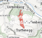
Schutzwälder mit Bescheid, Bannwälder, erklärte Erholungswälder
Sämtliche Schutzwälder mit Bescheid, die Bannwälder und die erklärten Erholungswälder Oberösterreichs wurden mit Kataster-Genauigkeit digitalisiert
Simple
Metadata
- File identifier
- FE1504AA-94EC-4EA5-8EC2-EF45169324E3 XML
- Metadata language
- de
- Character set
- UTF8
- Metadata standard name
-
OENORM A 2270
- Metadata standard version
-
Ausgabe 2016
- Date stamp
- 2026-03-23T15:49:47.334Z
- Metadata author
-
Organisation name Individual name Electronic mail address Role Amt der OÖ. Landesregierung
Dipl.-Ing., Roland, Paumann
Custodian
- Hierarchy level
- Dataset
- Dataset URI
-
H:\arcgis\Layerfiles\PlanungEntwicklung\Biologie\Schutzwälder mit Bescheid, Bannwälder, erklärte Erholungswälder.lyr
Identification
- Alternate title
-
DORIS_PE.GISDB.SCHUTZ_BANN_ERHOLUNGSWAELDER
- Date ( Publication)
- 2011-01-01
- Date ( Creation)
- 2010-01-01
- Date ( Revision)
- 2025-04-23
- Edition
-
Version 1.0
- Point of contact
-
Organisation name Individual name Electronic mail address Role Amt der OÖ. Landesregierung
Dipl.-Ing., Roland, Paumann
Point of contact
Descriptive keywords
- OGD Kategorien ( Theme)
-
-
Geographie und Planung
-
Umwelt
-
- OGD Keyword
-
-
Umwelt
-
Planungsunterlagen
-
Forstwirtschaft
-
- Keywords
-
-
Umwelt
-
Planungsunterlagen
-
Forstwirtschaft
-
Internetfreigabe
-
OGDFreigabe
-
Legal constraints
- Use limitation
-
no limitations
Legal constraints
- Access constraints
- Other restrictions
- Other constraints
-
Creative Commons Namensnennung 4.0 International (CC BY 4.0) https://creativecommons.org/licenses/by/4.0/deed.de
- Classification
- Unclassified
Technical information
- Denominator
- 2000
- Metadata language
- de
- Character set
- UTF8
- Topic category
-
- Planning cadastre
- Environment
Spatial Information
))
Temporal extent
Temporal extent
Data quality information
- Hierarchy level
- Dataset
- Statement
-
Datengrundlage: Bescheide
Conformance result
- Date ( Creation)
- 2011-08-19
- Date ( Revision)
- 2013-09-01
- Explanation
-
unbekannt
- Pass
- No
Reference System Information
- Projection
- EPSG:31255
Distribution Information
- Distribution format
-
Name Version Specification shapefile 1.0
ESRI Shapefile Technical Description
Overviews
Spatial extent
Provided by
